1316 Bozeman Avenue · Northern Pacific Addition · Helena, Montana

The Stone Warehouse in the Northern Pacific Addition

A history of the building at 1316 Bozeman Avenue — from the railroad land grant of 1864, through the earthquakes of 1935, to the family that closed its doors in 2026.

Prepared for the Joshua Tree project and the City of Helena Railroad Urban Renewal District · August 2026 · every statement carries its source

Contents
  1. In briefThe whole history in three paragraphs.
  2. A timeline1864 – 2026Every dated event in the life of the block, each with its source.
  3. IThe ground before the house1864 – 1883A land grant to a railroad, a rancher’s section, and an addition platted when the trains came.
  4. IIThe railroad comes to Helena1883 – 1887The first train, the depot street, and a suburb of warehouses and hotels.
  5. IIIThe stone warehouse1884Kleinschmidt & Co.’s stone merchandise house on its side track — the earliest image of the block.
  6. IVThe warehouse belt and the later maps1885 – 1934What the 1892 and 1930 surveys show of the stone houses on Bozeman Street.
  7. VNash-Finch and Christie Transfer1930sA wholesale grocer’s house and the transfer company that ran it.
  8. VIOctober 19351935 – 1936The earthquakes, the office that failed, the $900 permit, and the neighbor that fell.
  9. VIICapital Transfer & Storage1949 – 2026Three generations of the Horne family, and the deeds that carried the house.
  10. VIIIThe building today2026Stone under later skins, and the plan to restore its face.
  11. The maps1884 – 1930The Sanborn sheets and the historic plats.
  12. Sources and recordsEvery statement’s source, and the records behind this history.
In brief

This is a first-generation railroad warehouse. It stands on ground the United States granted to the Northern Pacific in 1864, in the addition the railroad opened when its trains reached Helena in June 1883. The fire-insurance surveyors who mapped Bozeman Street in 1884 and 1892 drew a stone merchandise house on this block, seventy-six feet by two hundred, with a loading platform on a Northern Pacific side track, labeled Kleinschmidt & Co. By 1930 the same street carried a second stone wholesale house, the Union Wholesale Grocery Company’s, with a concrete platform on a railroad spur — and the surveyors printed the number 1316 beside it.15 16

Fifty-one years later it was the Nash-Finch Company’s wholesale grocery house, run on the ground by Christie Transfer & Storage, when the earthquakes of October 1935 tore through the Sixth Ward. The liquor warehouse next door fell. This one did not. The city issued Nash-Finch a permit to rebuild the stone end walls and repair the roof — nine hundred dollars — and two weeks later the newspaper reported the warehouse “nearly restored.”1 4

From 1949 it was the house of Capital Transfer & Storage, three generations of the Horne family, who closed it on the first of July, 2026, after seventy-six years.27 It sits today inside the Railroad Urban Renewal District, just outside the boundary of the listed Helena Railroad Depot Historic District — and it is older than the last stone warehouse that district was able to list.14

The building in dates

A timeline

1864
July 2 — Congress charters the Northern Pacific and grants it the land.

In the middle of the Civil War, Congress chartered the Northern Pacific Railroad Company and granted it the odd-numbered sections of public land within a broad band on either side of the line it was to build from Lake Superior to Puget Sound. The county describes this parcel as Section 29 of Township 10 North, Range 3 West — an odd-numbered section inside the railroad’s primary limits. Whether these four lots passed from the United States to the railroad or to a private purchaser is written on a federal land patent that has not yet been retrieved.13 8 12

1871
May — Allen Wilkinson buys 134 acres in Section 29.

Twelve years before the railroad arrived, Allen Wilkinson purchased 134 acres in Section 29, the section this warehouse stands in. A cultural-resource survey of a neighboring site in the same section, prepared in 2014 for the Montana Business Assistance Connection, records that his property was “absorbed into the Northern Pacific Addition by 1883,” and that the railroad’s agent, the Montana National Bank, was later selling lots in the Addition. The Montana Historical Society holds an abstract of title for a lot in Block 19 of the Addition described as “established by Allen M. Wilkinson in 1870.”20 21

1883
June 13 — the first Northern Pacific train reaches Helena.

The city had graded the depot street in anticipation. The railroad’s depot stood a mile and a half from the old mining town on Last Chance Gulch, and the railroad’s trustees began selling the lots around it as soon as they could be platted. The Northern Pacific Addition became the depot suburb — a working district of freight houses, hotels, saloons and boarding houses that would later be known as the Sixth Ward.14

1884
January — capital pours into the Addition. November — the surveyors draw the stone warehouse.

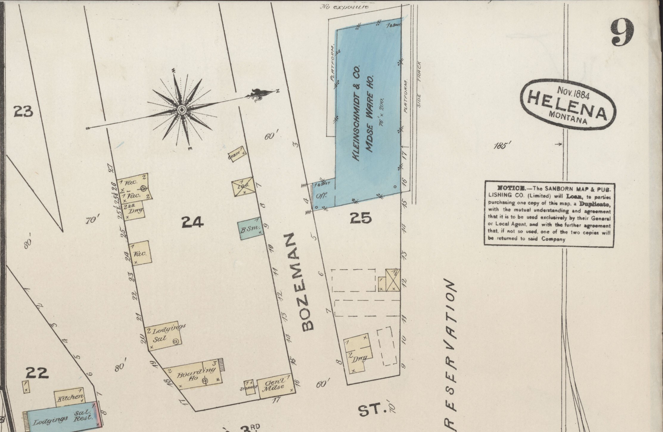
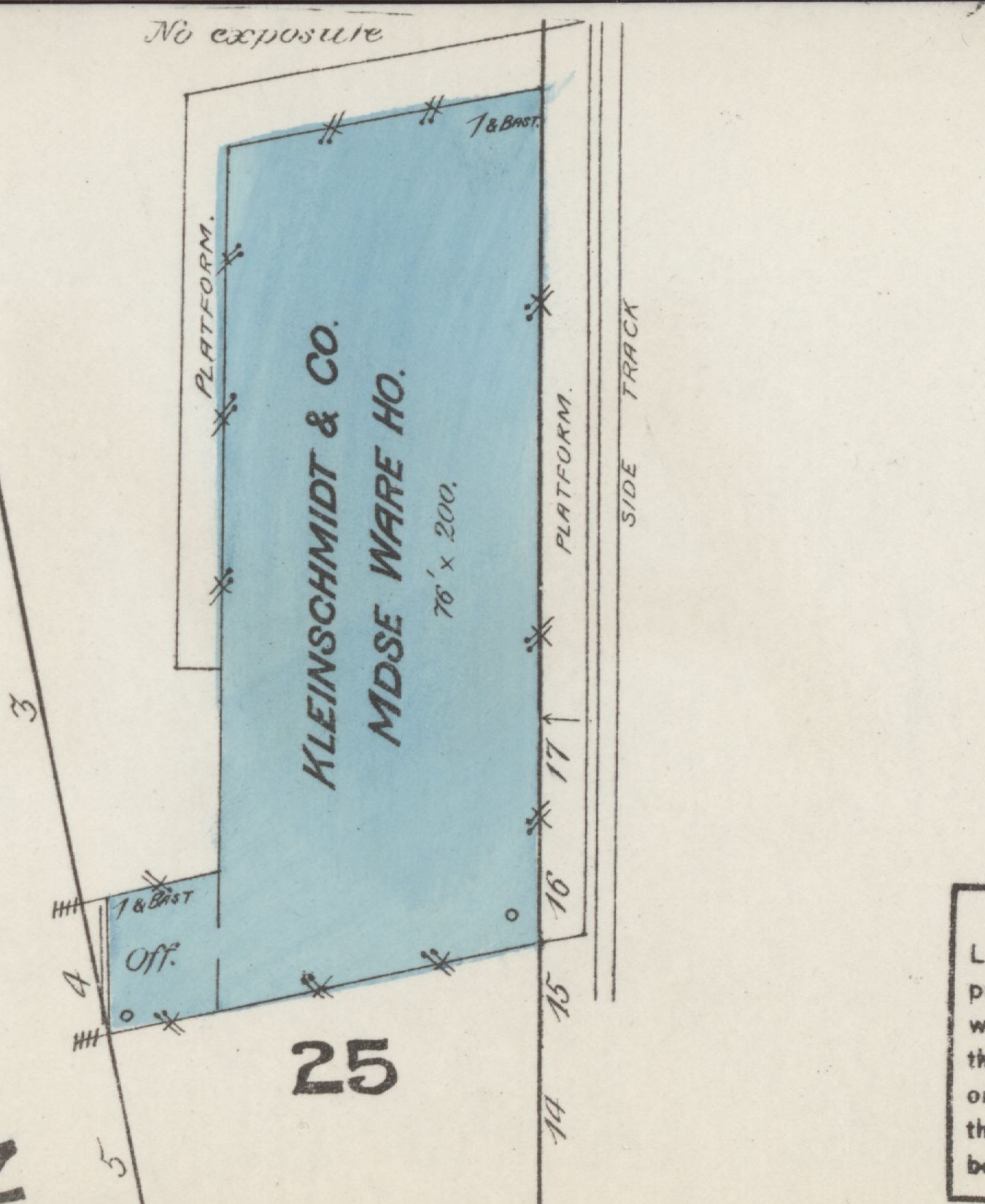
In January the Helena Weekly Herald reported that “a great deal of capital” had already been spent in the Addition: the Elite Saloon, the Grand Pacific Hotel, the Denver Hotel, Kirkendall’s warehouse. In November the Sanborn Map & Publishing Company surveyed the town for the fire-insurance companies — nine sheets for a city of ten thousand — and on sheet 9 drew a stone merchandise warehouse on Block 25, between Bozeman Street and the railroad reservation: “Kleinschmidt & Co. Mdse Ware Ho.,” seventy-six feet by two hundred, colored blue for stone, with a small office at one corner, a loading platform along the wall that faced the tracks, and a side track between the platform and the Northern Pacific main line. The same year’s city directory lists Kleinschmidt Bros. & Co., general merchandise, on Main Street, and Theodore H. Kleinschmidt as mayor of Helena and assistant cashier of the First National Bank. The stone house on Bozeman Street was the family’s rail-side warehouse.7 15 24

1887
“A population has sprung up around the Northern Pacific station.”

Northwest Magazine described the depot suburb in those words four years after the first train. The Addition had become a town of its own at the tracks.14

1888
September 3 — the Union Mercantile Company incorporates in Helena.

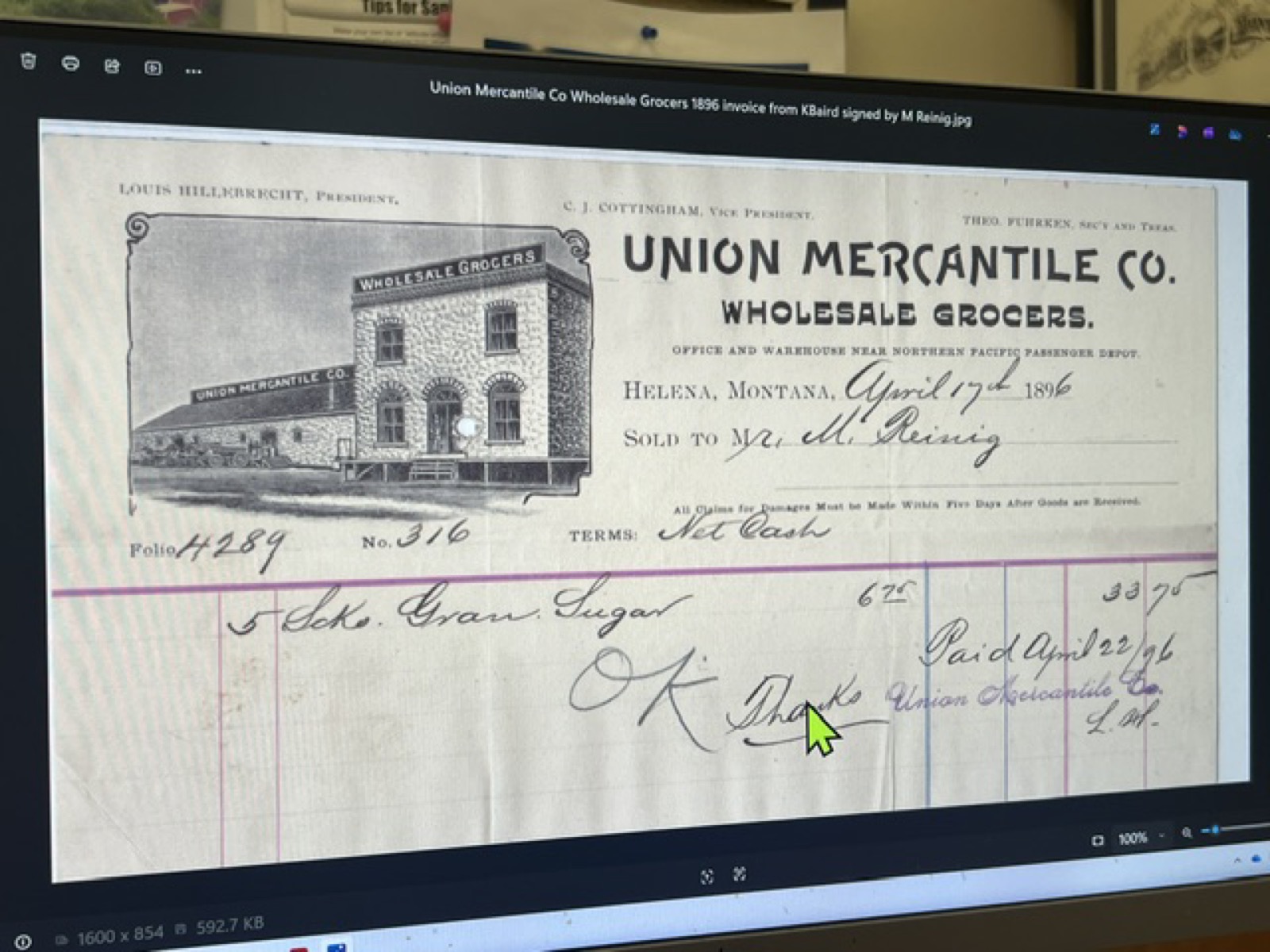
A Montana domestic corporation, file D000745, with its principal office in Helena and no street address in the filing; the record now reads “inactive, expired.” The name matters because it returns on this street: an 1896 invoice among the project’s papers is headed Union Mercantile Company, wholesale grocers, near the Northern Pacific depot, and the 1930 map places a Union Wholesale Grocery Company stone house at 1316 Bozeman.26

1892
The Sanborn map is redrawn — the stone house is still Kleinschmidt’s.

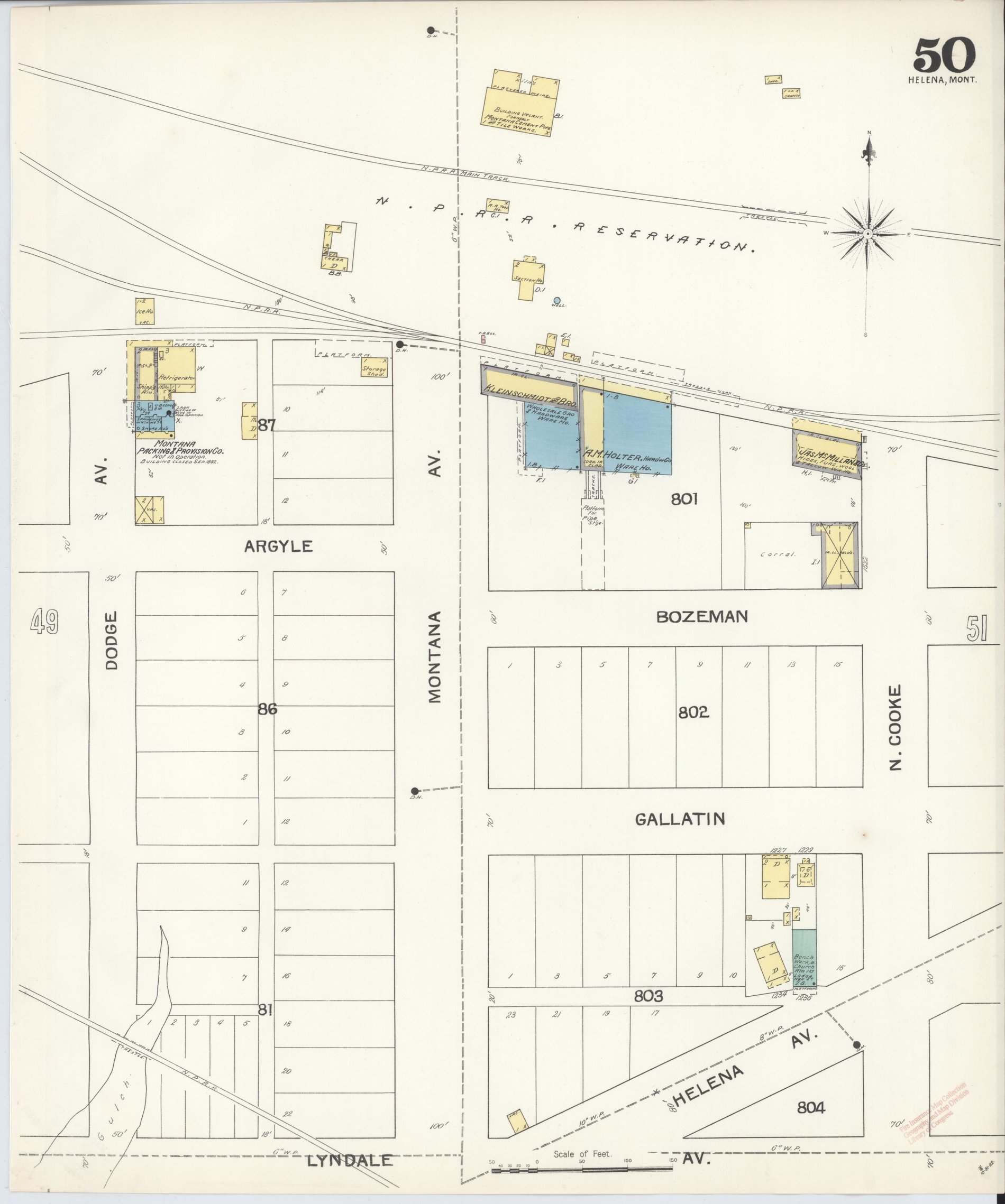
The city now needed sixty-four sheets. On sheet 50 the same stone house stands on the same block, labeled “Kleinschmidt & Bro. — Wholesale Gro. & Hardware Ware Ho.,” with a loading platform along the railroad side and another along its west wall. Beside it, also in stone, stands A. M. Holter’s hardware warehouse; at the east end of the block, at Cooke Street, James McMillan & Co.’s hides, furs and wool house. The Kleinschmidt family firm dealt in groceries and hardware from about 1879 to 1896.16 30

1896
The last stone warehouse the depot district would list is built — and an invoice names Union Mercantile.

About 1896 the Benson-Carpenter Company built its rubblestone warehouse at 1439 North Harris, the building the National Register nomination would later call “the last standing warehouse in the district” and the “sole survivor of an extensive complex.” The stone house on Bozeman Street is twelve years older. The same year, an invoice of the Union Mercantile Company — “wholesale grocers,” near the Northern Pacific depot — was written; it survives among the papers gathered for this project.14 26

1930
The Sanborn map prints “1316” on Bozeman Street.

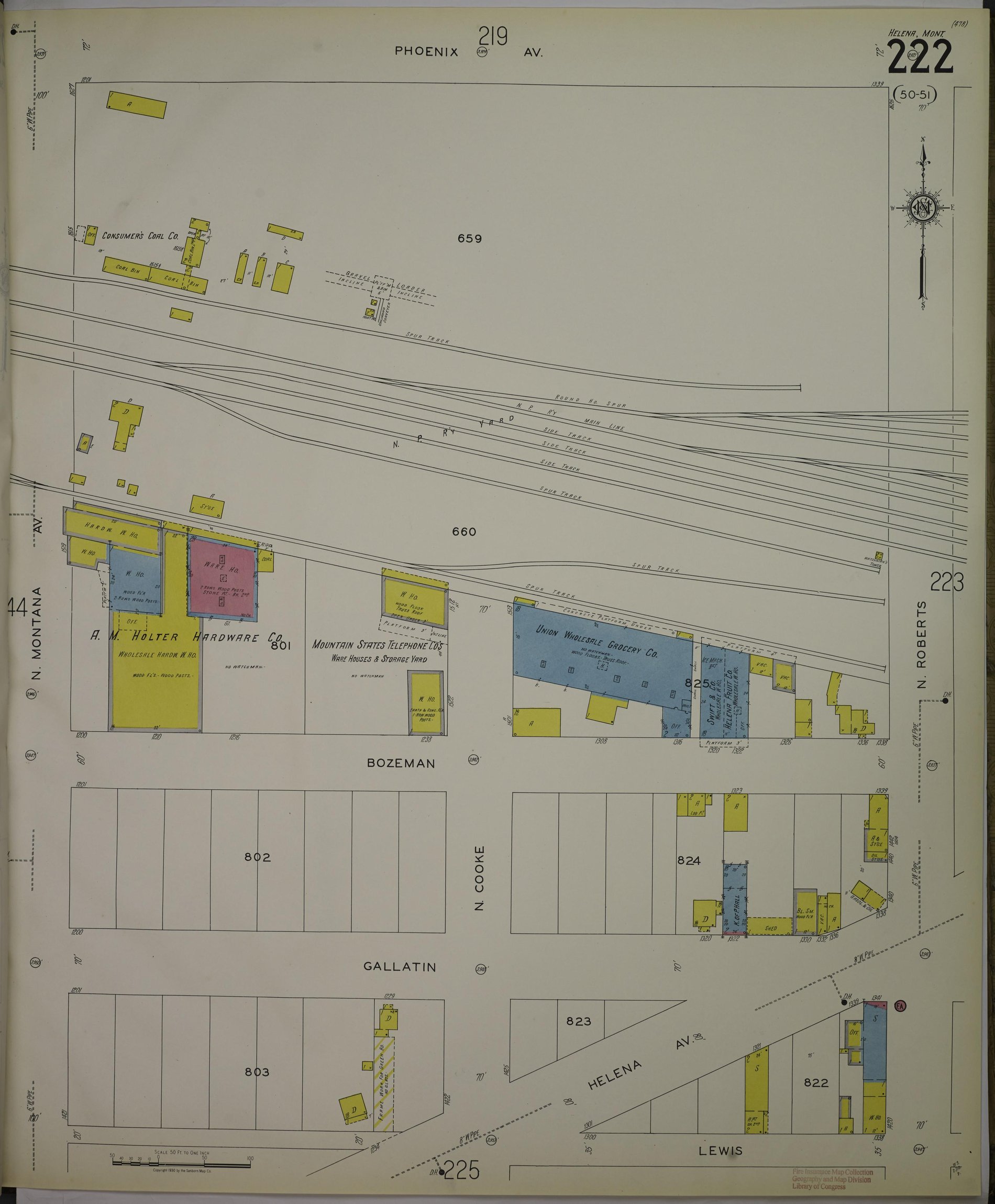
The city needed eighty-one sheets by 1930, and sheet 222 shows a changed street. West of Cooke Street, where the Kleinschmidt house had stood, the surveyors drew A. M. Holter Hardware Company’s wholesale warehouses — a frame house on the corner of Montana Avenue, a stone warehouse twenty-four feet wide, and a warehouse of stone below and brick above — with the Mountain States Telephone Company’s storage yard beyond. East of Cooke Street they drew a long stone house in blue: “Union Wholesale Grocery Co. — wood floors, truss roof,” with a concrete loading platform under its north wall and a railroad spur alongside; then Swift & Company’s wholesale house, then the Helena Fruit Company’s. Along the street they printed the house numbers 1300, 1308, 1316, 1320, 1322, 1326, 1336 and 1338. The number 1316 sits at the east end of the Union Wholesale Grocery house.16

1935
October — the Helena earthquakes.

The series began with small shocks on October 3 and a damaging shock of about magnitude 5.9 on October 12. At 9:48 on the evening of Friday, October 18, the main shock — magnitude 6.2, about twelve seconds long — struck a city of stone and brick, with its epicenter less than a mile east of the Northern Pacific depot. The Helena Independent of the next morning reported: “The Nash Finch wholesale grocery company’s office had the rear end torn out. The Christie Transfer company’s warehouse was badly shattered, and practically demolished.” Two Nash-Finch employees, David Carlton Shope and Bernice Roland, were at work in the office and got into the street before the walls crumbled; they were married in Missoula the following night. Next door, most of the roof of the State Liquor Board’s warehouse — managed by Christie — fell in and pushed the walls out onto a freight car of whisky, nearly striking an employee named Ray Howe; a photographer recorded a Christie truck in the rubble the next morning. On October 31 the paper printed the repair permits issued by the city engineer, Oscar Baarson, since the shock; among them: “Nash-Finch company; rebuild end walls and repair roof of company’s stone warehouse building; $900.” That same morning, at 11:37, a magnitude 6.0 aftershock struck. On November 12 the paper reported that in the warehouse district at the depot “the Nash-Finch, A. M. Holter and other warehouses are nearly restored to their former condition.” A magnitude 5.5 shock followed on November 28; some eighteen hundred tremors were recorded between October and the following April.28 1 3 2 19 4 6

1936
The State Liquor Warehouse leaves Bozeman Street.

The liquor house next door had been slated for replacement before the earthquake; construction of a new plant had begun that October on the north end of the Great Northern yard. After the October and November shocks demolished the Bozeman Street building, the Board operated for a time from the Empson Building on Placer Avenue, and in 1936 opened its new warehouse on Front Street at Lyndale — designed by Norman B. DeKay, built by Cahill-Mooney of Butte — where it stayed until 1978. The neighbor was gone from Bozeman Street. The stone warehouse remained.22

1949
Capital Transfer & Storage is founded.

A Helena family founded a moving and storage company that would operate from this warehouse for the next seventy-six years. It was started by John Horne’s grandfather and father; his grandmother and his mother worked in it too. John came on full-time in 1971, his brother in 1974, and in time John’s son worked there as well. The company moved households and offices, warehoused and shipped and stored, and painted its name across the long white wall of the stone house facing the street.27

1995
May 26 — the earliest instrument on the public index.

Dorothy M. Horne and Capital Transfer & Storage mortgaged Northern Pacific Addition Block 25, Lots 1 through 4, to Norwest Bank of Montana — the earliest instrument on the county’s online index for these lots, and proof that the family already owned the warehouse by then. A release recorded that June refers back to an older mortgage in Book M3, page 278, which has not yet been read. The mortgages that followed, in 1997, 2005 and 2007, cite the same four lots and a city ordinance, No. 1758, that runs through the Addition’s titles and most likely accounts for the thirty-five feet of closed Cooke Street the tax card attaches to the parcel.10

2004
December 15 — the Helena Railroad Depot Historic District is listed.

The National Register district (NRIS 03001330) covers the depot, twenty-three buildings, a park, the brick-paved depot street and three objects, for the period 1884–1956. Its nomination quotes the Independent of October 19, 1935 on Nash-Finch and Christie Transfer. 1316 Bozeman lies just outside the boundary, east of North Harris — the same kind of building the district was drawn to protect, and older than the last stone warehouse inside it.14

2007
November 14 — the company becomes an LLC. December 31 — the estate deed.

Capital Transfer & Storage LLC was organized on November 14, 2007, with John L. Horne as its registered agent at 1316 Bozeman Avenue. On December 31, Dorothy M. Horne’s estate deeded the warehouse to John L. Horne — Book M37, page 7167, instrument 3141282, prepared by the Harlen Law Firm of Helena — a succession within the family, not a sale. The same deed was recorded again on May 26, 2010. In 2018 John Horne also bought the lots across the street at 1315 Bozeman, on Block 24.26 10 9

2020
August 29 — a Helena historian names 1316 in a photograph of the earthquake.

Captioning the Knudsen & Son photograph of the wrecked liquor warehouse, the Helena historian Kennon Baird placed it “adjacent to the Nash-Finch food and beverage distributor warehouse, 1316 Bozeman,” and added that “the warehouse was managed by the Christie Transfer & Storage Co.” This is the sentence that ties the 1935 newspaper record to the house number.23

2026
July 1 — Capital Transfer & Storage closes after seventy-six years.

Eight people worked there at the end, many for decades. John Horne, the last of the family in the business, said the closing was the industry’s doing — the difficulty of finding workers after the pandemic — and that what he would remember was the customers, whose thank-you cards covered the office walls. He emptied the warehouse himself. The building was then leased to Stephen Banker of Joshua Tree, a cabinetry business, whose plan is to restore the exterior — the doors, the windows and their arches, the window wells, the stone and the pointing, the gutters — so that the warehouse recovers its historic face. The parcel lies in the city’s Railroad Urban Renewal District, and the application that this history accompanies asks the district to share in that work.27 32 8

Chapter I

The ground before the house

The land under this warehouse entered private hands the way most of the ground along the Northern Pacific did: by act of Congress. On July 2, 1864, in the middle of the Civil War, Congress chartered the Northern Pacific Railroad Company and granted it the odd-numbered sections of public land within a broad band on either side of the line it was to build from Lake Superior to Puget Sound.13 The county describes this parcel as Section 29 of Township 10 North, Range 3 West — an odd-numbered section, inside the railroad’s primary limits.8

The first private owner the record names in Section 29 is Allen Wilkinson. A 2014 cultural-resource survey of a neighboring site in the same section, prepared for the Montana Business Assistance Connection, traces the story: in May 1871, twelve years before the railroad arrived, Wilkinson purchased 134 acres in Section 29, and his property was “absorbed into the Northern Pacific Addition by 1883.”20 The Montana Historical Society holds an abstract of title for a lot in Block 19 of the same Addition, described as “established by Allen M. Wilkinson in 1870.”21 The Addition, in other words, grew out of a rancher’s section-land before the railroad ever laid a rail across it.

Whether these particular four lots passed from the United States to the railroad or to Wilkinson, and on what date, is recorded on a federal land patent in the General Land Office records. That patent has not yet been retrieved; it is a free document and is listed among the open questions at the end of this history.

Chapter II

The railroad comes to Helena

The first Northern Pacific train reached Helena on June 13, 1883.14 The city had graded the depot street in anticipation. The railroad’s depot stood a mile and a half from the old mining town on Last Chance Gulch, and the railroad’s trustees began selling the lots around it as fast as they could be platted. The Northern Pacific Addition was born as the depot suburb — a working district of freight houses, hotels, saloons and boarding houses that would later be known as the Sixth Ward.14

By January 1884 the Helena Weekly Herald was reporting that “a great deal of capital” had already been spent in the Addition — the Elite Saloon, the Grand Pacific Hotel, the Denver Hotel, Kirkendall’s warehouse.7 Three years later Northwest Magazine could write that “a population has sprung up around the Northern Pacific station.”14 Wholesale houses followed the tracks. The warehouse district on Bozeman Street is the direct result: the railroad placed a depot and an addition on the edge of town, and the merchants who moved goods by the carload built their warehouses beside the side tracks.

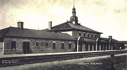
The Northern Pacific passenger depot at Helena, about 1904, from a postcard
The Northern Pacific depot at Helena, about 1904. The station that gave the neighborhood its name and its business. Postcard, Wikimedia Commons — public domain.33
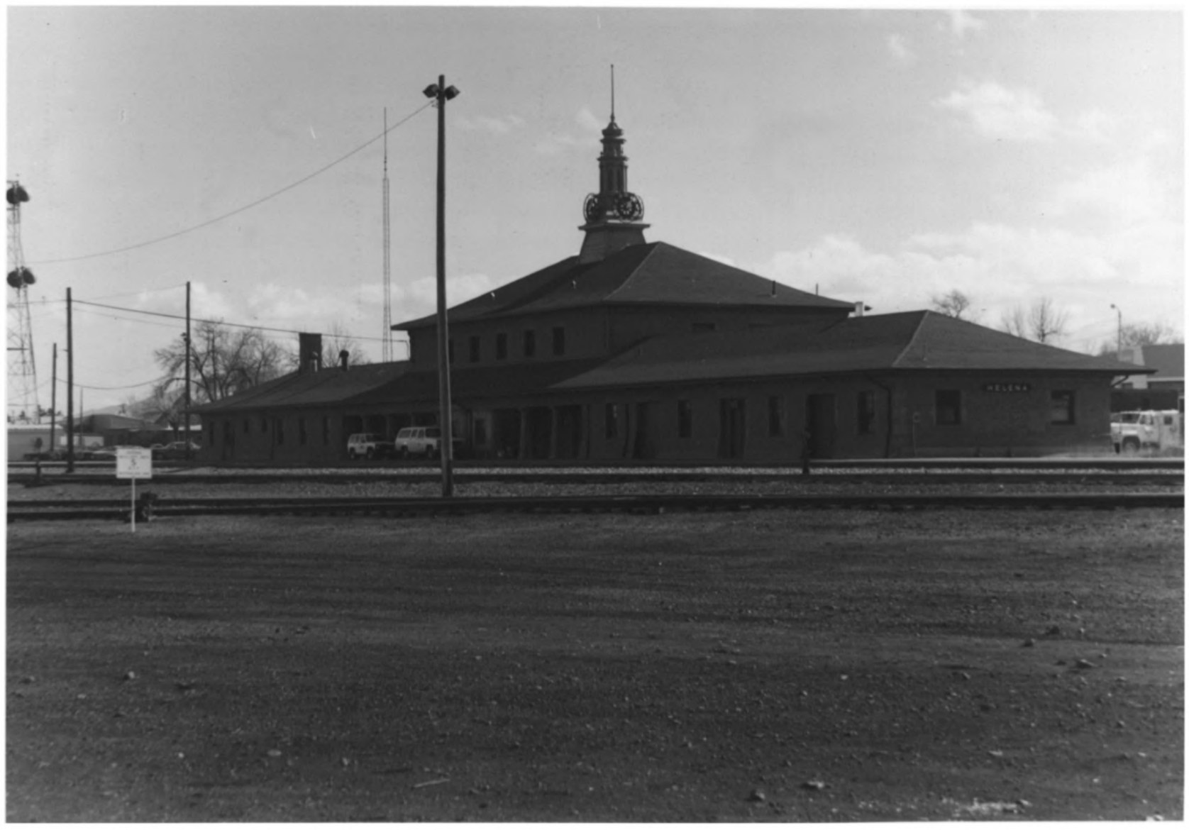
The Northern Pacific depot at Helena photographed from the southeast in 1995 for the National Register nomination, with its clock tower and covered platform
The depot in 1995, photographed from the southeast for the National Register nomination of the depot district. National Park Service — public record.14
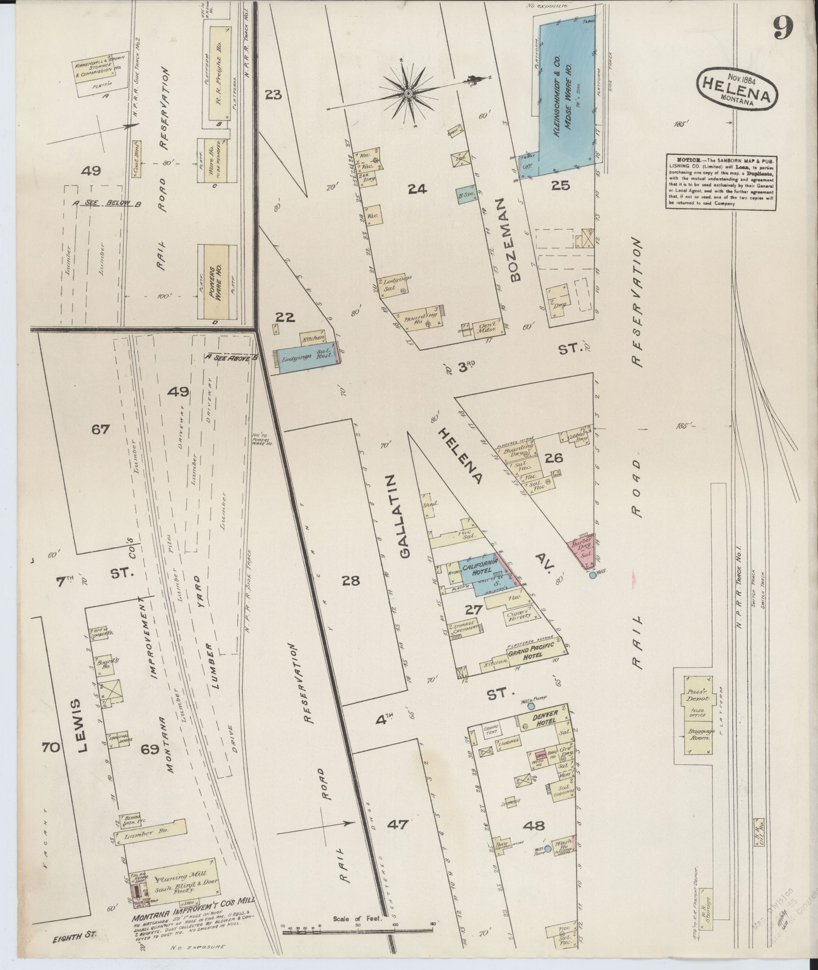
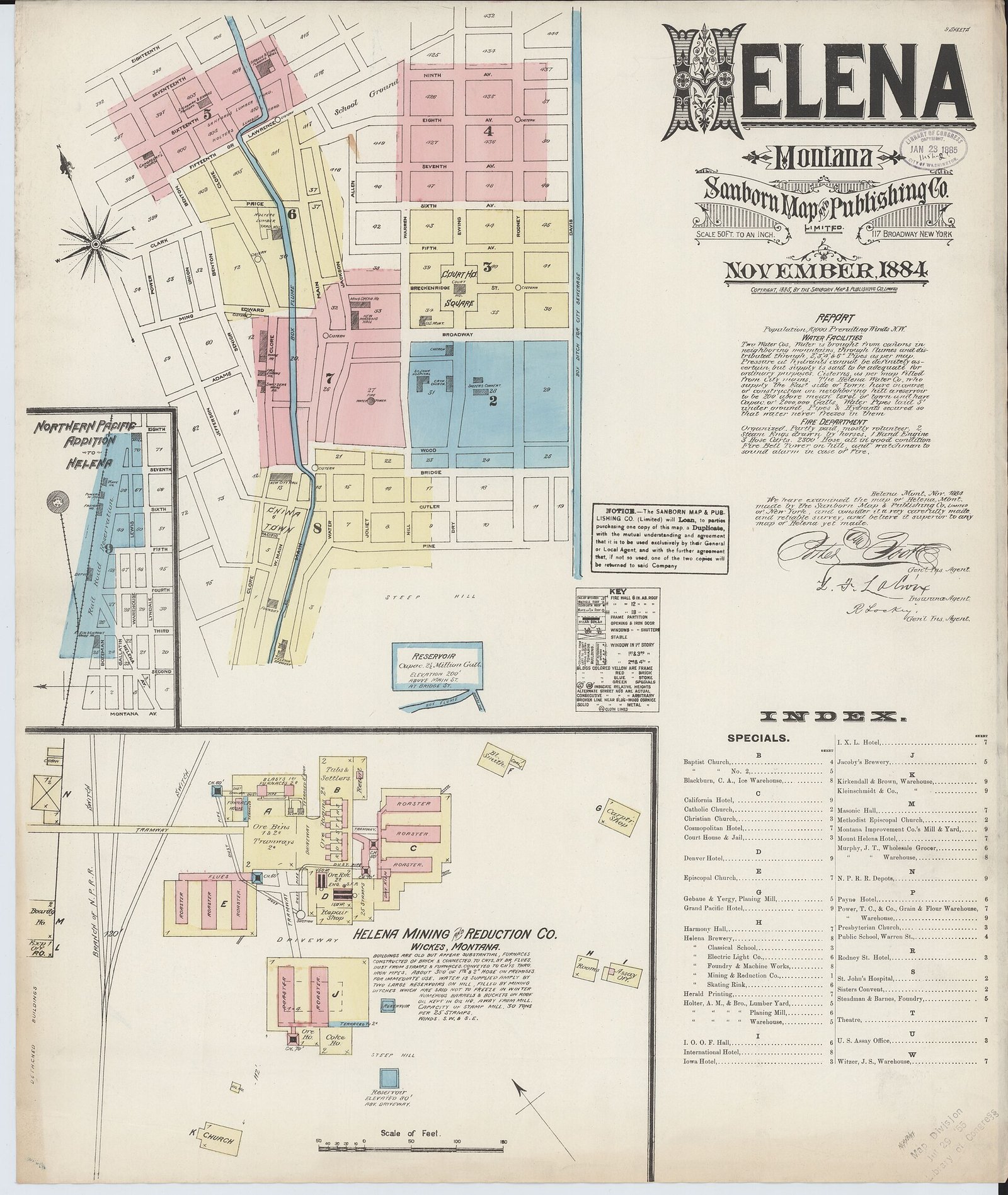
The Northern Pacific Addition on the November 1884 Sanborn fire-insurance map of Helena, sheet 9: Bozeman Street, Blocks 23 to 28, the rail road reservation, the passenger depot, the California and Grand Pacific hotels
The depot suburb, November 1884. Sheet 9 of the Sanborn fire-insurance map of Helena: Bozeman Street and the Northern Pacific rail road reservation; Blocks 23, 24 and 25; the California Hotel, the Grand Pacific Hotel and the Denver Hotel along Helena Avenue; Powers’ warehouse, the Kirkendall & Brown storage and commission house, the Montana Improvement Company’s lumber yard and planing mill; the passenger depot with its telegraph office and baggage room at lower right. Sanborn Map & Publishing Co., Library of Congress — public domain.15
Chapter III

The stone warehouse — Kleinschmidt & Co., 1884

The earliest surviving image of a warehouse on this block is a surveyor’s drawing, made in November 1884 for the fire-insurance companies, seventeen months after the first train arrived.

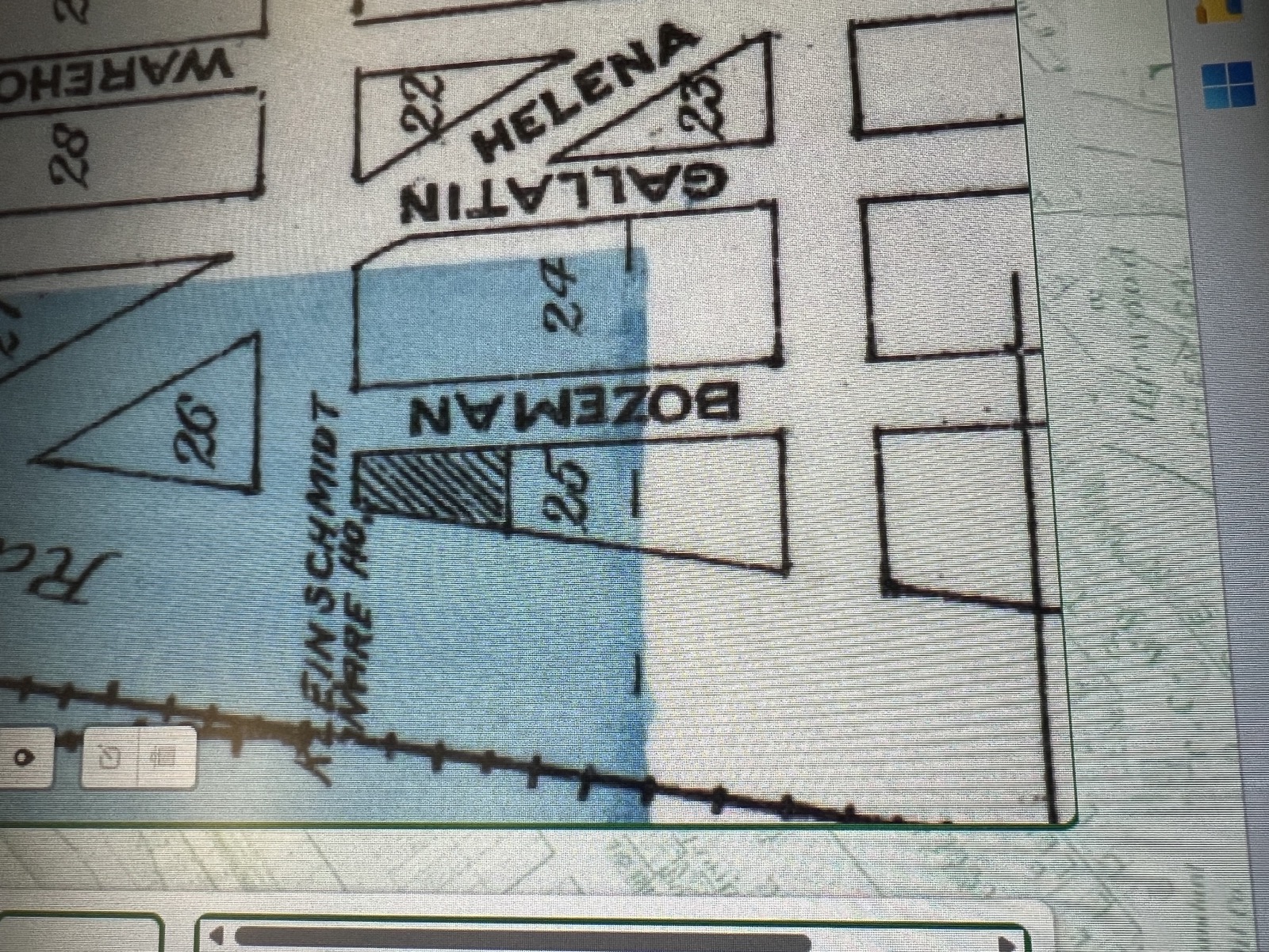
Block 25 on the November 1884 Sanborn map: the Kleinschmidt & Co. merchandise warehouse drawn in blue for stone, 76 by 200 feet, with a platform and side track along the Northern Pacific reservation and Bozeman Street below
Block 25, November 1884. The warehouse is drawn in blue — the surveyors’ color for stone — and labeled “Kleinschmidt & Co. Mdse Ware Ho.,” 76 by 200 feet, with a small office at the corner, a loading platform the length of the east wall, and a side track between the platform and the Northern Pacific main line. Bozeman Street runs below it; Block 24 lies across the street. Sanborn Map & Publishing Co., Helena, sheet 9. Library of Congress / Wikimedia Commons — public domain.15

The Sanborn Map & Publishing Company surveyed Helena in November 1884 — nine sheets for a town of ten thousand — and its index of special buildings sends the reader to sheet 9 for “Kleinschmidt & Co., Warehouse” and for the Northern Pacific depots.15 On that sheet, on the block between Bozeman Street and the rail road reservation, the surveyors drew a long stone building and wrote its dimensions on it: seventy-six feet by two hundred. They colored it blue, the code for stone. They drew a small office at one corner, a platform along the wall that faced the tracks, and a side track running between the platform and the Northern Pacific main line, so that a freight car could be spotted at the door. They labeled the block “25.”15

The tax card for 1316 Bozeman Avenue today reads: Northern Pacific Addition, Block 25, Lots 1 through 4, together with thirty-five feet of closed Cooke Street.8 The surveyors of 1884 wrote “25” on the block that held the Kleinschmidt house — the block between what are now Montana Avenue and Cooke Street, on the north side of Bozeman, backing on the railroad. Today’s parcel is on that same street, at Cooke Street, with a piece of the vacated street inside its lines. What the 1884 map settles beyond argument is the age of the neighborhood’s first stone warehouse: the Northern Pacific reached Helena in June 1883, and a finished stone merchandise house seventy-six by two hundred feet was standing on this block by November 1884, in the first building season of the depot suburb.15 Whether that house is the building standing at 1316 today is taken up in the next chapter, where the later maps are read.

The Kleinschmidts

The name on the warehouse belonged to one of Helena’s leading merchant families. The 1884 city directory lists Kleinschmidt Bros. & Co., general merchandise and commission, on the west side of Main Street between Edwards and Price, and A. Kleinschmidt & Co., wholesale and retail grocers and liquor dealers, at the corner of Main and Grand. Theodore H. Kleinschmidt was that year the mayor of Helena and assistant cashier of the First National Bank.24 The family firm dealt in groceries and hardware from about 1879 to 1896.30 Their stores were downtown on Main Street; the stone house on Bozeman Street was their rail-side merchandise warehouse, where the carloads came in.15 24

A fire-insurance map records who used a building, not who owned it. Whether the Kleinschmidts held title to the four lots, or leased them from the railroad’s agents as other merchants in the Addition did, is a question for the deed books at the county clerk, which are indexed from 1865 but not yet read for these lots before 1995.10

Chapter IV

The warehouse belt, 1885–1934 — what the later maps show

The Sixth Ward filled with warehouses. The 2004 National Register nomination for the Helena Railroad Depot Historic District describes a district of freight houses and wholesalers gathered around the depot, and records that the last standing warehouse inside its boundary is the Benson-Carpenter Company building at 1439 North Harris — rubblestone, built about 1896, “sole survivor of an extensive complex.”14 Bozeman Street, east of North Harris, lies just outside the line the nomination drew, in what the nomination itself calls the warehouse belt that continued beyond the district’s core.14

The Sanborn company came back to Helena in 1892, and again in 1930, and both surveys of this block are in the Library of Congress. Read together with the 1884 sheet, they show how the street changed over forty-six years.

1892 — the stone house is still Kleinschmidt’s

Eight years on, the city needed sixty-four map sheets instead of nine. On sheet 50 the same stone house stands on the same block, drawn in blue, now labeled “Kleinschmidt & Bro. — Wholesale Gro. & Hardware Ware Ho.,” with a loading platform along the Northern Pacific side and another along its west wall. Beside it, also in stone, stands A. M. Holter’s hardware warehouse; at the east end of the block, at Cooke Street, James McMillan & Co.’s hides, furs and wool house. The Kleinschmidts had held their railroad warehouse for at least eight years, and the block had become a row of wholesale houses on the tracks.16

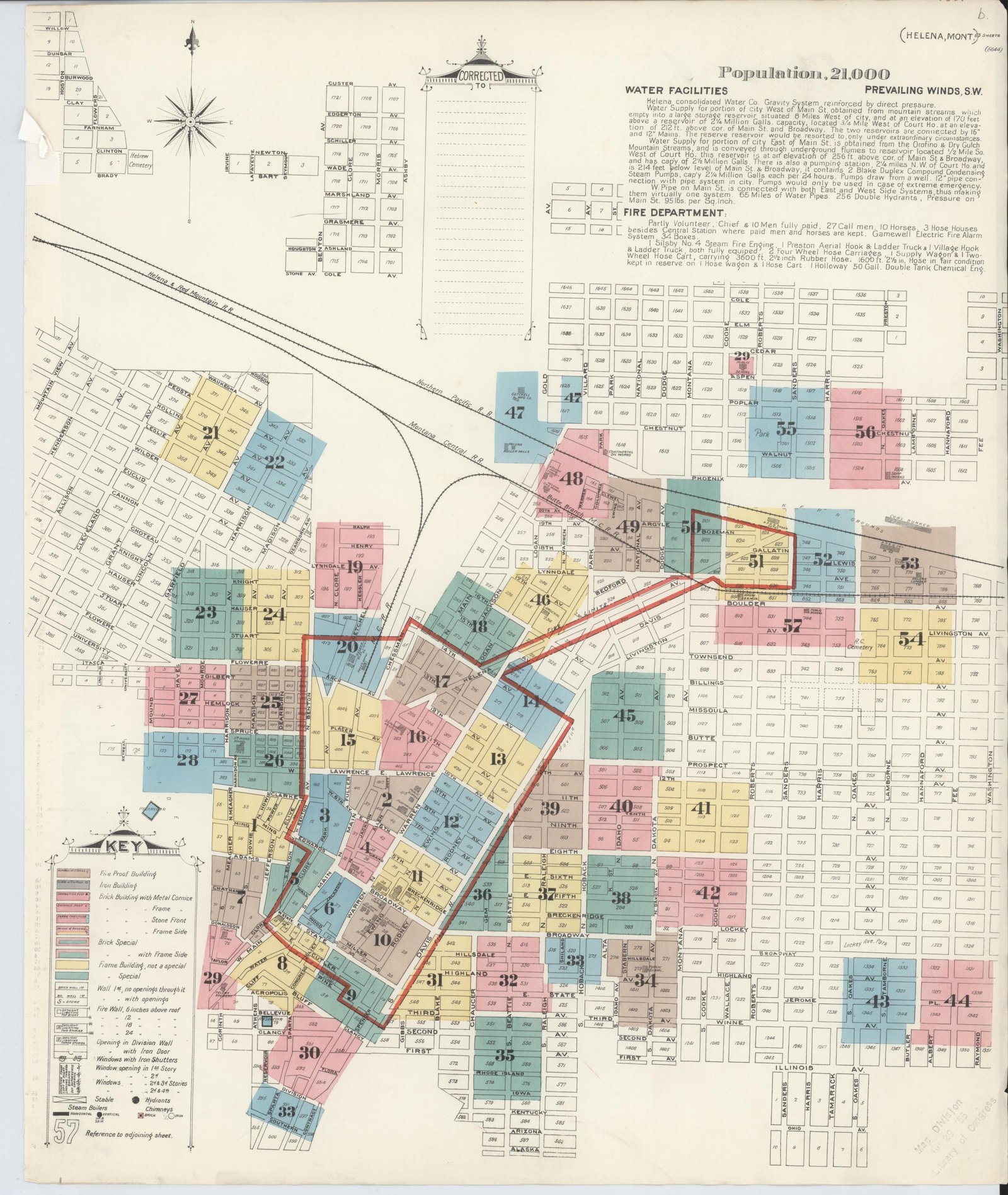
Sheet 50 of the 1892 Sanborn map of Helena: Bozeman Street, the Northern Pacific reservation, the Kleinschmidt & Bro. wholesale grocery and hardware warehouse in blue for stone, A. M. Holter's hardware warehouse beside it, and James McMillan & Co.'s hides and wool house at Cooke Street
Bozeman Street, 1892. Sheet 50 of the Sanborn map: the Kleinschmidt & Bro. stone warehouse on its platform, A. M. Holter’s hardware warehouse beside it, McMillan’s hides-and-wool house at the corner of North Cooke; the Northern Pacific reservation and main track above; Bozeman, Gallatin and Helena Avenue below. Sanborn Map Company, Library of Congress — public domain.16

1930 — the number 1316 appears

By 1930 Helena needed eighty-one sheets, and on sheet 222 the street had changed. West of Cooke Street, where the Kleinschmidt house had stood, the surveyors drew A. M. Holter Hardware Company’s wholesale warehouses — a frame house on the corner of Montana Avenue, a stone warehouse twenty-four feet wide, and a warehouse of stone below and brick above — with the Mountain States Telephone Company’s storage yard beyond them. The seventy-six-by-two-hundred stone box of 1884 is not drawn as such; what stands there is smaller, and partly rebuilt in brick.16

East of Cooke Street, on the block the surveyors numbered 825, they drew a long stone house in blue — “Union Wholesale Grocery Co. — no watchman, wood floors, truss roof” — with a concrete loading platform under its north wall and a railroad spur track running alongside. Along Bozeman Street they printed the house numbers of that block: 1300, 1308, 1316, 1320, 1322, 1326, 1336, 1338. The number 1316 sits at the east end of the Union Wholesale Grocery house, where Swift & Company’s wholesale house adjoined it; next door again stood the Helena Fruit Company’s wholesale house.16

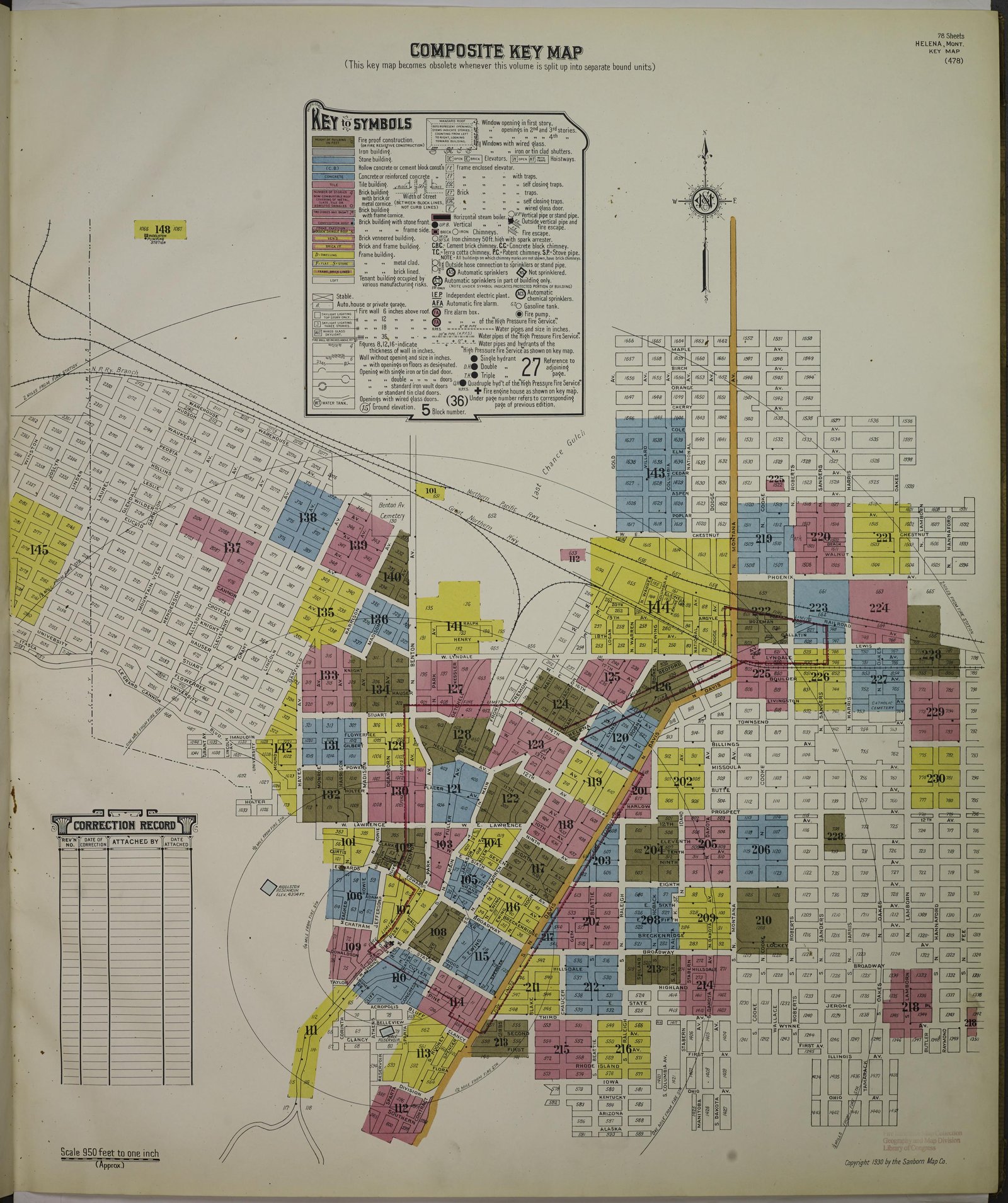
Sheet 222 of the 1930 Sanborn map of Helena: the Northern Pacific yard, A. M. Holter Hardware Company's warehouses west of North Cooke, and east of Cooke the Union Wholesale Grocery Company's stone house with a concrete platform on a spur track, with Swift & Co. and the Helena Fruit Company beside it and the house numbers 1300 to 1338 along Bozeman
Bozeman Street, 1930. Sheet 222 of the Sanborn map. West of North Cooke: A. M. Holter Hardware Company’s warehouses and the telephone company’s yard. East of Cooke: the Union Wholesale Grocery Company’s stone house on its concrete platform and spur track, Swift & Co., the Helena Fruit Company — and the numbers 1300 through 1338 printed along the street. Sanborn Map Company, Library of Congress — public domain.16

What the three maps mean

Two stone wholesale houses stood on Bozeman Street between the 1880s and 1930, one on each side of Cooke Street, and the maps place the house number 1316 on the eastern one. The eastern house is the one that fits the story the newspapers tell five years later: a stone wholesale grocery warehouse — Nash-Finch’s by 1935 — standing next to the fruit house that had become the State Liquor Board’s warehouse, the neighbor that fell in the earthquake “adjacent to the Nash-Finch food and beverage distributor warehouse, 1316 Bozeman.”23 22 The Union Wholesale Grocery Company’s name, too, has an earlier echo on this street: among the papers Diane gathered is an 1896 invoice of the Union Mercantile Company, “wholesale grocers,” near the Northern Pacific depot — a Helena corporation organized in 1888 whose filing gives no street address.26 The same name appears on the same street thirty-four years apart. Whether the one firm became the other is a question for the corporate records; the 1930 map is the first document that places a Union wholesale grocery house at this number.

Today’s parcel — Block 25, Lots 1 through 4, with thirty-five feet of Cooke Street closed and folded into it — sits at Cooke Street, the seam between the two blocks. The building at 1316 Bozeman is a stone railroad warehouse of the first generation of the depot suburb, on a block that has held stone wholesale houses on Northern Pacific platforms since 1884.

An 1896 Union Mercantile Company wholesale grocers invoice from Helena, near the Northern Pacific depot, from the project research files
Union Mercantile Company, wholesale grocers, Helena, 1896. An invoice from the project’s research files. The firm was incorporated in Helena in 1888; in 1930 the Union Wholesale Grocery Company’s stone house stood at 1316 Bozeman.26
Chapter V

Nash-Finch and Christie Transfer

By the 1930s the stone warehouse at 1316 belonged to the trade the depot suburb was built for: wholesale groceries. The 1930 map names the Union Wholesale Grocery Company at the number; by the autumn of 1935 the newspapers name the Nash-Finch Company’s “stone warehouse” in the same warehouse district, and the trucks at its door belonged to Christie Transfer & Storage.16 4 23

Nash-Finch was one of the great grocery wholesalers of the northern plains. It began in 1885 as a confectionery and tobacco store in Devils Lake, North Dakota, kept by Fred Nash and his brothers Edgar and Willis. After a fire it moved to Grand Forks. In 1889 a railroad car of peaches arrived there with no buyer; the brothers borrowed the money to take the whole car, sold it, and were wholesalers from then on. They hired their first employee outside the family, Harry B. Finch, to clean fruit; he rose to run the company. Between 1907 and 1919 the firm built or bought fifty-four fruit houses across the northwestern states and Canada, and in November 1919 it moved its headquarters to Minneapolis. It incorporated in Delaware in 1921 as the Nash Finch Company. Its private label, “Our Family,” came out of the Depression years; its Helping Hand Society, founded in 1922 to care for the sick, the aged and the poor, became the Nash Foundation.21

The Helena house was one of those fruit-and-grocery warehouses on the line. The 1935 newspapers refer to it simply as the company’s “stone warehouse.”4 The local historian who later identified the building in a photograph of the earthquake wrote that “the warehouse was managed by the Christie Transfer & Storage Co.”23 Christie was a Helena drayage and storage firm with its own warehouse in the Sixth Ward; it handled the State Liquor Board’s warehouse on Bozeman Street as well, next door.2 In the fall of 1935 those were the two names on this block.

Chapter VI

October 1935 — the earth shook, and the stone house stood

The Helena earthquakes of 1935 were a series, not a single night. The first small shocks came on October 3. A damaging shock on October 12 measured about magnitude 5.9. Then, at 9:48 on the evening of Friday, October 18, the main shock — magnitude 6.2, twelve seconds long — struck a city of stone and brick.28

The epicenter lay less than a mile east of the Northern Pacific depot, and so the depot district took the blow.23 The Helena Independent of the next morning headlined the damage in the Sixth Ward and walked the warehouse belt building by building. At the National Biscuit warehouse on Boulder Avenue, at the railroad land office, along the 1400 block of Railroad Avenue, and here:

“The Nash Finch wholesale grocery company’s office had the rear end torn out. The Christie Transfer company’s warehouse was badly shattered, and practically demolished.”Helena Independent, October 19, 1935 — quoted again in the National Register nomination for the depot district1 14

Two of Nash-Finch’s people were in that office when it failed. David Carlton Shope and Bernice Roland were at work on Friday night; they got out and into the street before the walls started to crumble, and Shope’s car was buried under falling brick. They were married in Missoula the following night anyway.3

Next door, the earthquake finished a building that was already on its way out. The State Liquor Board’s warehouse on Bozeman Street — the old Lindsay Fruit Company building, managed by Christie — had been slated for replacement since the spring; construction of a new plant had begun that month on the Great Northern yard. On the night of the eighteenth most of its roof fell in and pushed the walls out; one wall came down on a freight car of whisky that was being unloaded and nearly struck an employee named Ray Howe. “A considerable amount of whisky was lost.”2 The following morning a photographer recorded a Christie truck in the rubble, loading the cases that could be saved. That photograph is the one image of this block from 1935 that survives in a public archive. It shows the neighbor that fell. The stone warehouse stood beside it, outside the frame.19

The photograph — Bozeman Street, October 19, 1935

A Christie Transfer & Storage truck in the wreck of the State Liquor Warehouse the morning after the main shock, cases of liquor being carried out. Montana Historical Society Library & Archives, photograph PAc 2015-23.19, via the Montana History Portal. The Society lists the image as in copyright, educational use permitted; reproduction is arranged through its Photograph Archives. It is therefore linked here rather than reproduced. The building in the picture is the liquor warehouse. 1316 Bozeman stood next door.19

View at the Montana History Portal →

The Northern Pacific yards themselves were wrecked — every brick building twisted, half of a great chimney down, the shops in ruins, the roundhouse foreman reported.2 The city engineer, Oscar Baarson, began issuing repair permits the day after the shock, and on October 31 the Independent printed the list. One line on it is the most important sentence in the history of this building:

“Nash-Finch company; rebuild end walls and repair roof of company’s stone warehouse building; $900.”Helena Independent, October 31, 1935 — “Building Permits Issued to Repair Damage of Quake”4

It is a city permit, printed in the paper of record, for a stone warehouse belonging to Nash-Finch. The work is repair — end walls and roof — not demolition, and nine hundred dollars in 1935 was the cost of putting a damaged building back, not of replacing one. The permit was taken out before the great aftershock of October 31, which came at 11:37 that morning at magnitude 6.0; the company was already rebuilding its stone house when the ground moved again.4 28

Two weeks later the paper reported on the recovery of the district:

“Reconstruction of a number of the commercial buildings of the city was proceeding rapidly, notably in the warehouse district at the Northern Pacific depot. Badly damaged, the Nash-Finch, A. M. Holter and other warehouses are nearly restored to their former condition to meet the demands of their business.”Helena Independent, November 12, 19356

The warehouse was damaged, repaired, and back in trade within a month. The shocks went on — a magnitude 5.5 on November 28, and some eighteen hundred recorded tremors between October and the following April — but the stone warehouse had already been put right.28 The liquor house next door was never rebuilt on Bozeman Street; the State Liquor Board opened its new warehouse on Front Street in 1936, designed by Norman B. DeKay and built by Cahill-Mooney of Butte.22 The State Liquor Board’s operation left Bozeman Street; the stone warehouse remained.

One qualification is necessary. The 1935 newspaper lines name the company and call its building a stone warehouse; they do not print the house number. The identification of that stone warehouse as 1316 Bozeman rests on the Helena historian Kennon Baird, who, captioning the Knudsen photograph in 2020, placed the liquor wreck “adjacent to the Nash-Finch food and beverage distributor warehouse, 1316 Bozeman.”23 The city’s own permit file for October 1935, which would carry the address line, has not yet been pulled from the Building Division. That file would settle the address beyond question.
Chapter VII

Capital Transfer & Storage — the Hornes, 1949–2026

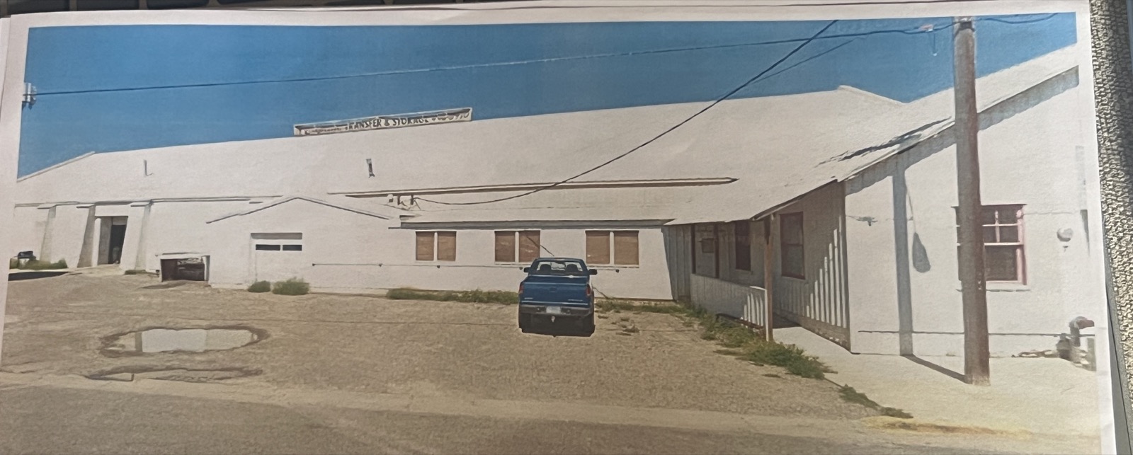
In 1949 a Helena family founded a moving and storage company that operated from this warehouse for the next seventy-six years. Capital Transfer & Storage was started by John Horne’s grandfather and father; his grandmother and his mother worked in it too. John came on full-time in 1971, his brother in 1974, and in time John’s son worked there as well — three generations of one family in one building.27 The company moved households and offices, warehoused and shipped and stored, and painted its name across the long white wall of the stone house facing the street: Transfer & Storage Co.

A photographic print of the warehouse at 1316 Bozeman Avenue in the Capital Transfer & Storage years: the long building painted white, the words Transfer & Storage across the upper wall, a blue pickup parked in front, the office wing at right
The warehouse in the Capital Transfer & Storage years. The long stone house painted white, “Transfer & Storage Co.” lettered across the upper wall, the office wing at the right. A print from the family’s and the project’s papers.32

The public land records pick the family up in 1995. On May 26 of that year Dorothy M. Horne and Capital Transfer & Storage mortgaged Northern Pacific Addition Block 25, Lots 1 through 4, to Norwest Bank of Montana — the earliest instrument on the county’s online index for these lots, and proof that the family already owned the warehouse by then; a release recorded that June refers back to an older mortgage, in Book M3, page 278, that has not yet been read.10 The mortgages that followed, in 1997, 2005 and 2007, all cite the same four lots and a city ordinance, No. 1758, that runs through the Addition’s titles and most likely accounts for the thirty-five feet of closed Cooke Street the tax card attaches to the parcel.10

On November 14, 2007, the family organized Capital Transfer & Storage LLC, with John L. Horne as its registered agent at 1316 Bozeman Avenue.26 On December 31, 2007, Dorothy M. Horne’s estate deeded the warehouse to John L. Horne — Book M37, page 7167, instrument 3141282, prepared by the Harlen Law Firm of Helena — a succession within the family, not a sale; the same deed was recorded again in May 2010.10 In 2018 John Horne also bought the lots across the street at 1315 Bozeman, on Block 24.9

Capital Transfer & Storage closed on July 1, 2026, after seventy-six years. Eight people worked there at the end, many of them for decades. John Horne, the last of the family in the business, told the local station that the closing was the industry’s doing — the difficulty of finding workers after the pandemic — and that what he would remember was not the trucks or the warehouse but the customers, whose thank-you cards and notes covered the walls of the office.27 He emptied the warehouse himself.

Chapter VIII

The building today

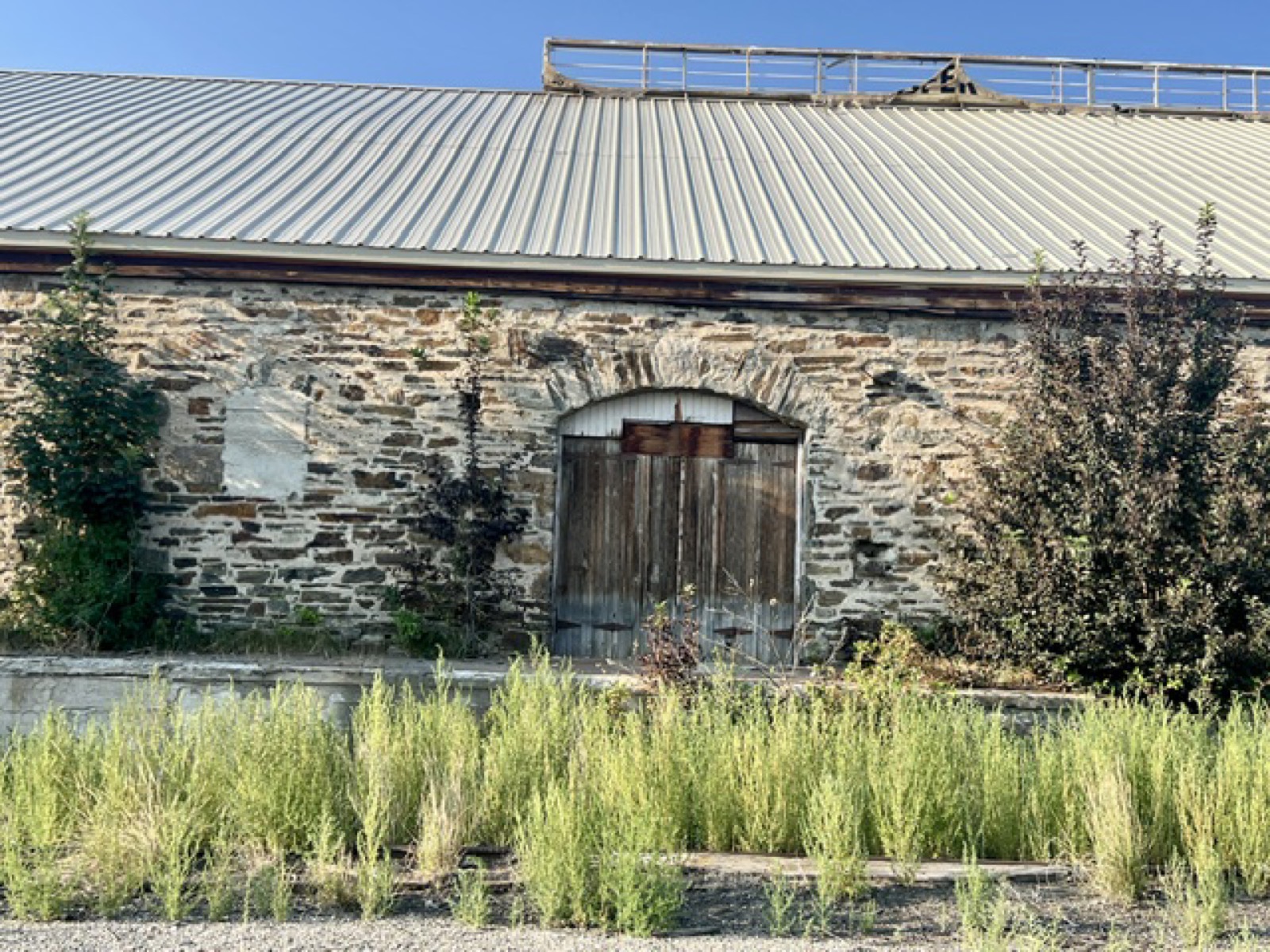
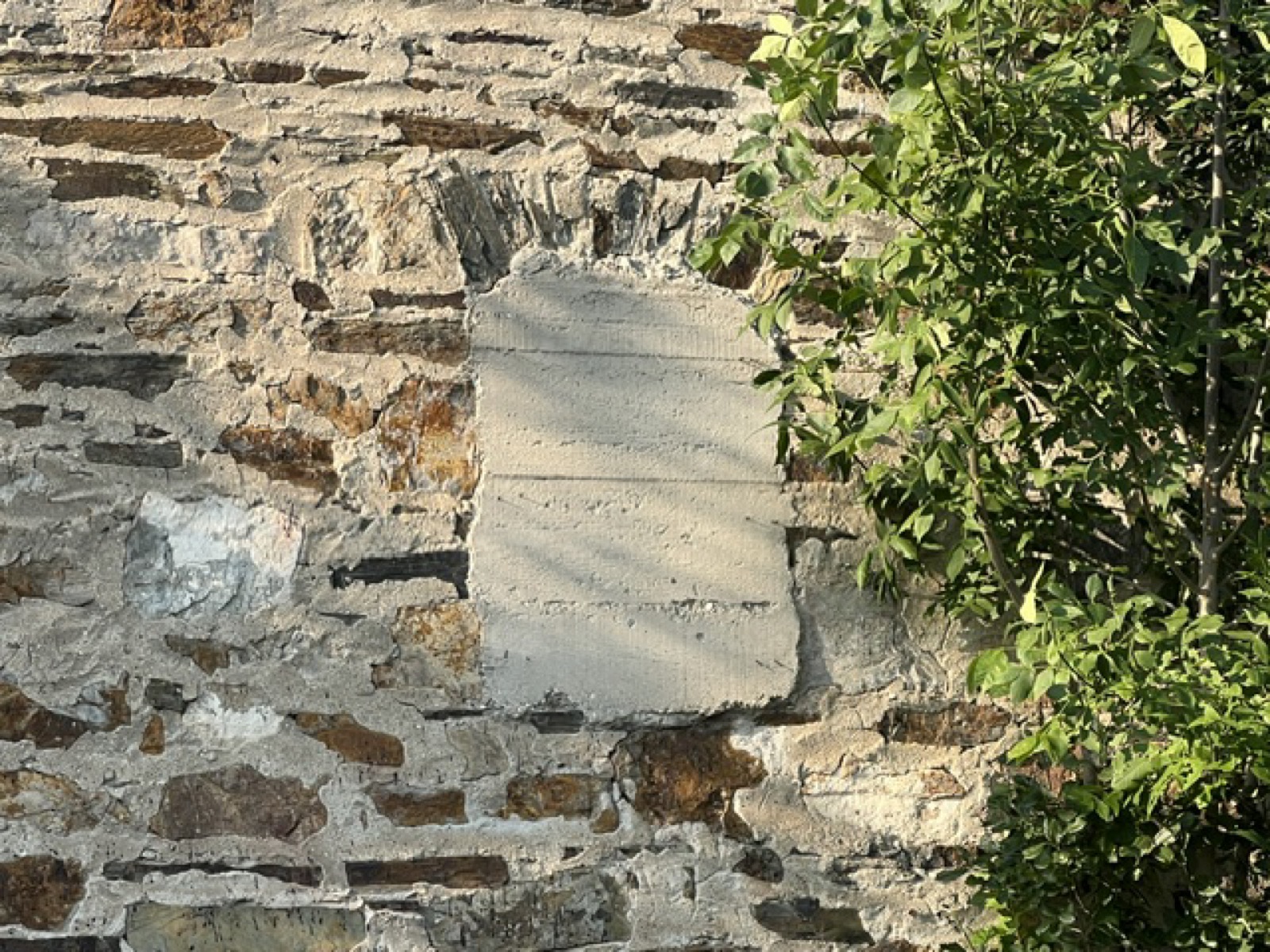
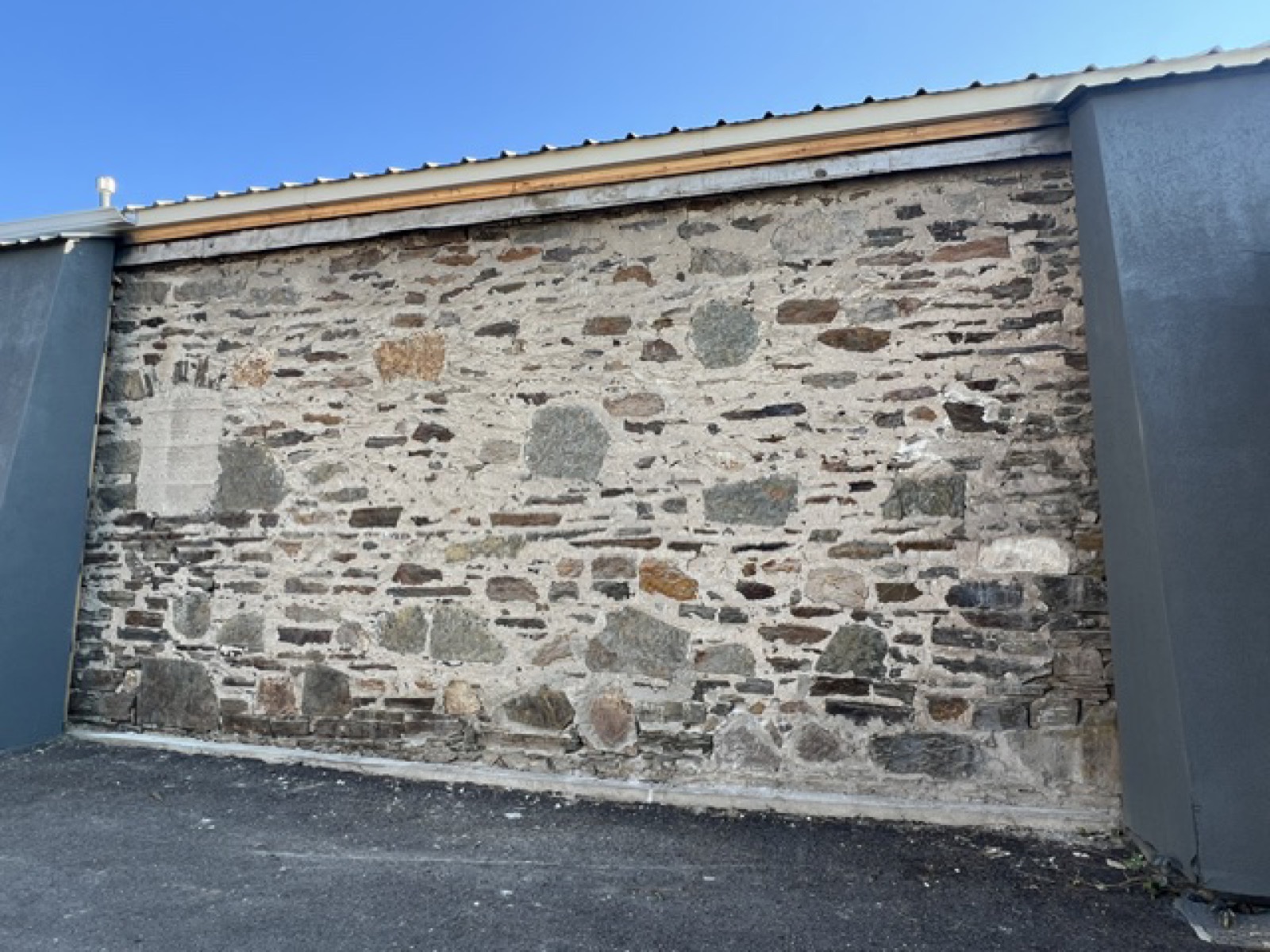
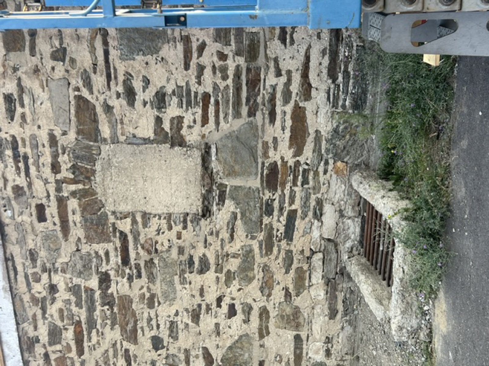
Where the later siding has been removed, the building shows its construction: rubble stone laid in lime mortar, in walls that have carried a roof for well over a century.

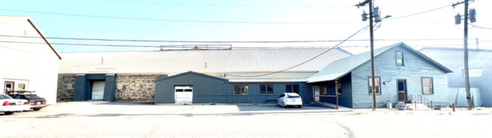
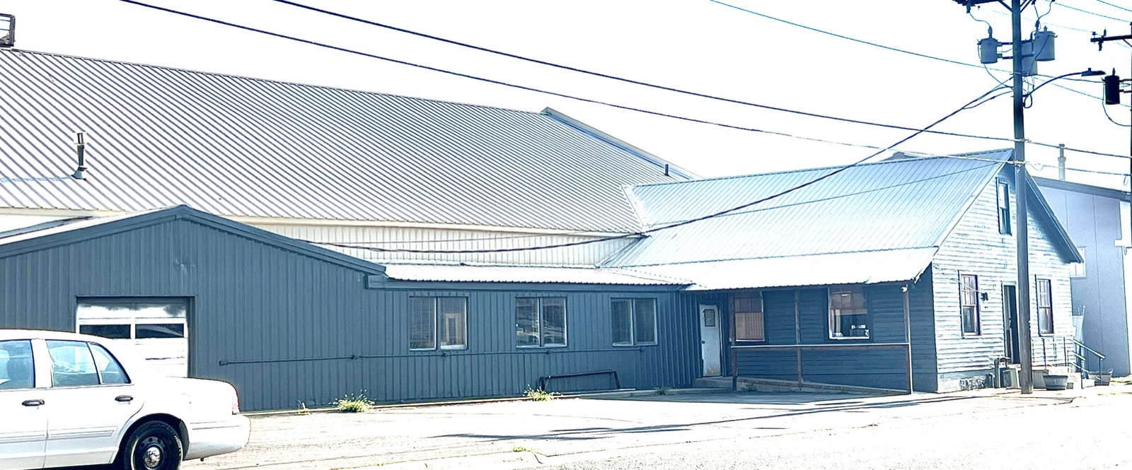
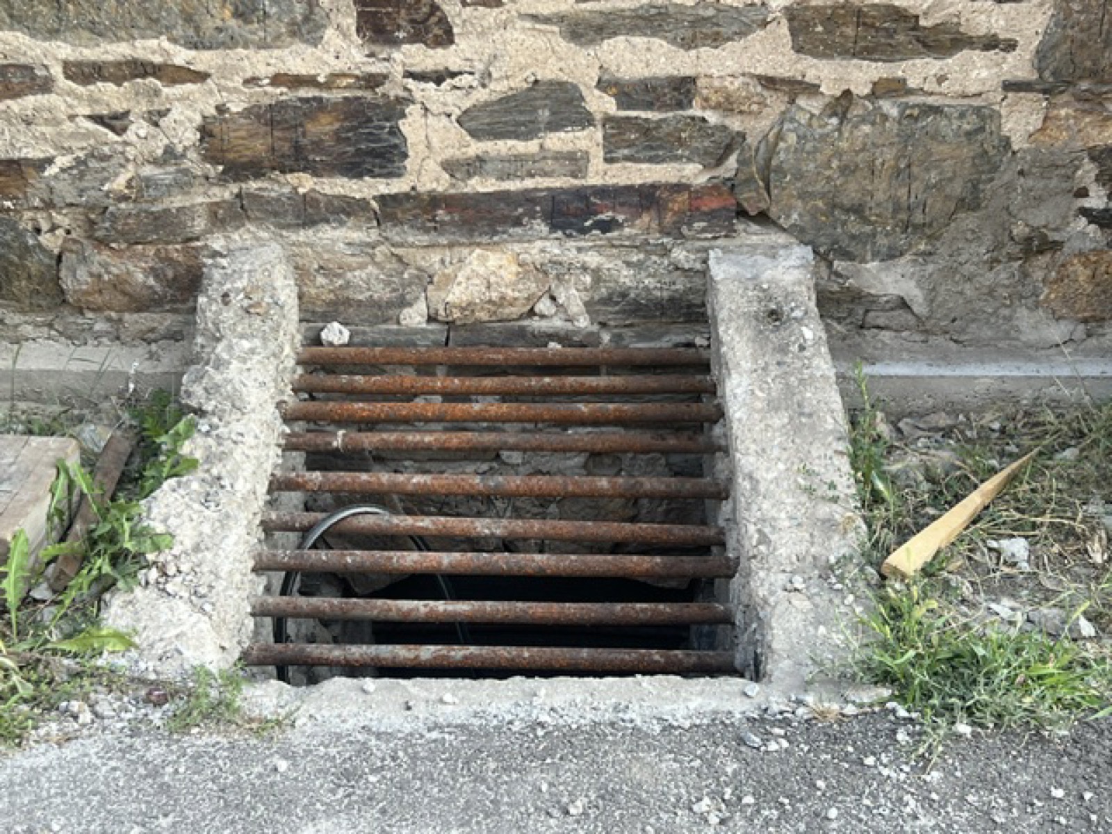
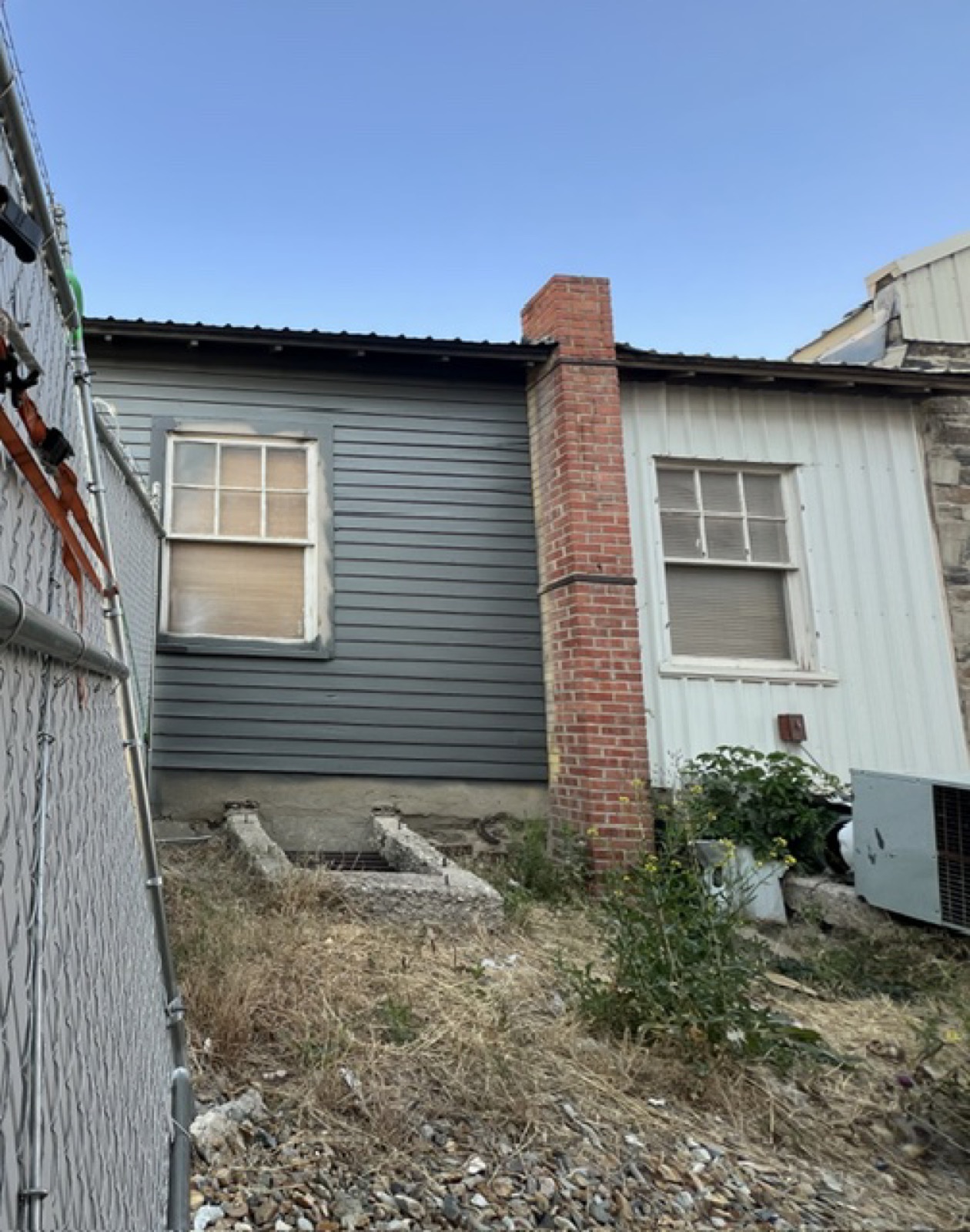
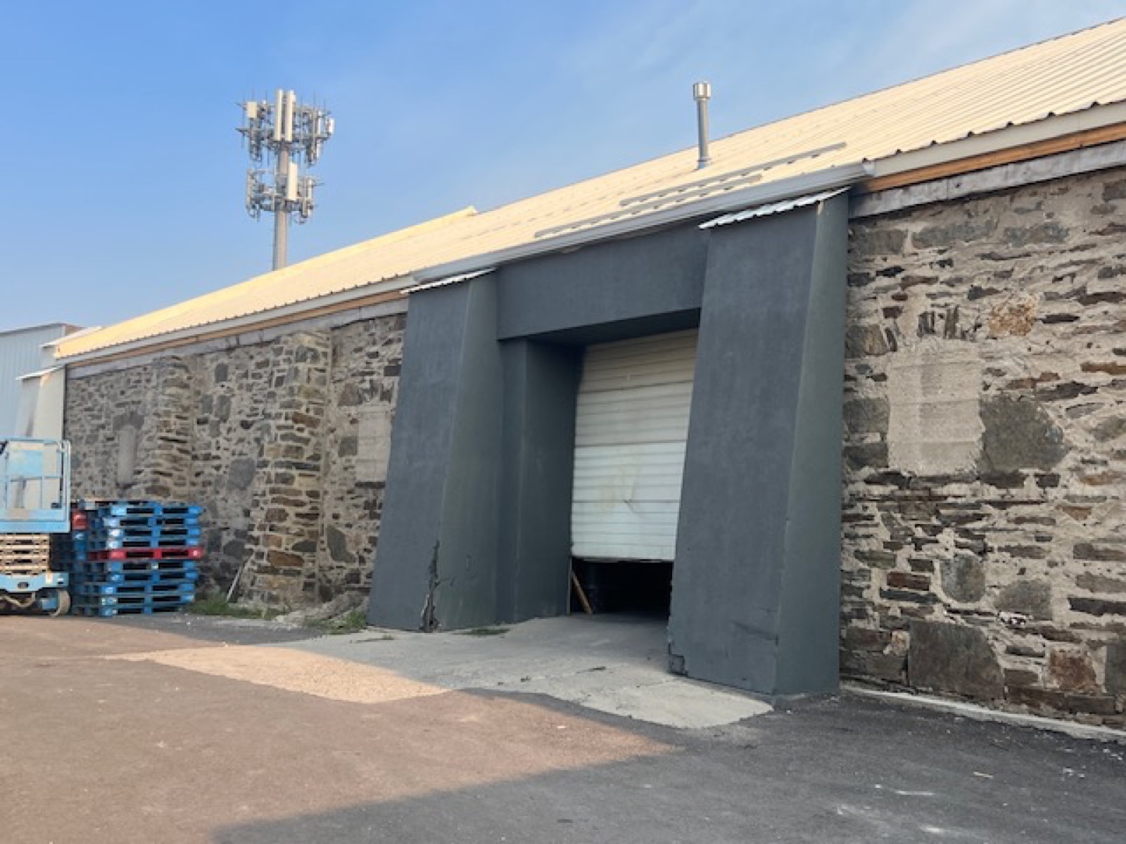
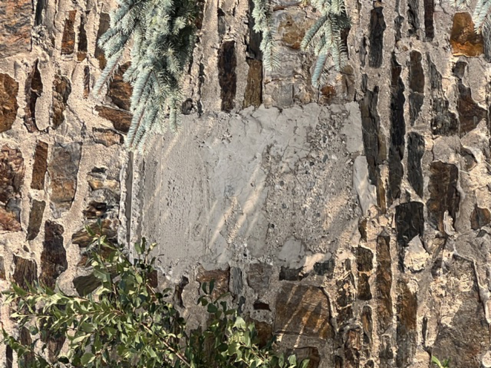
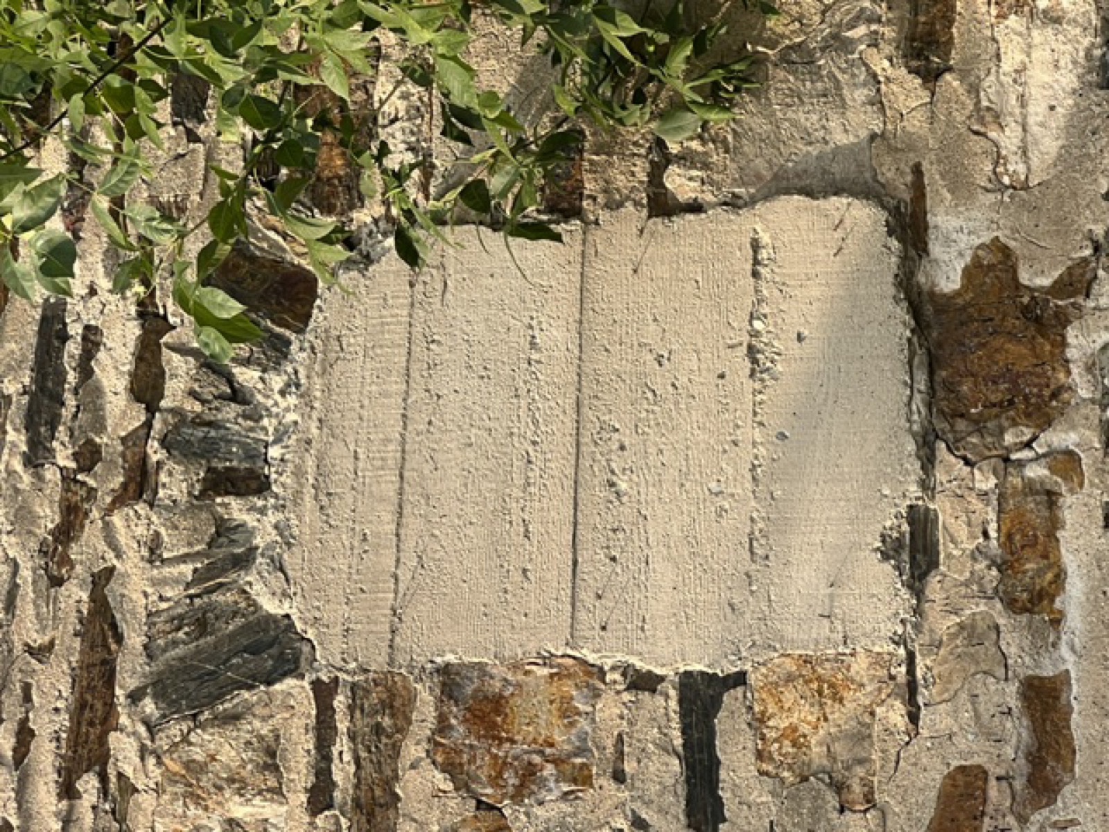
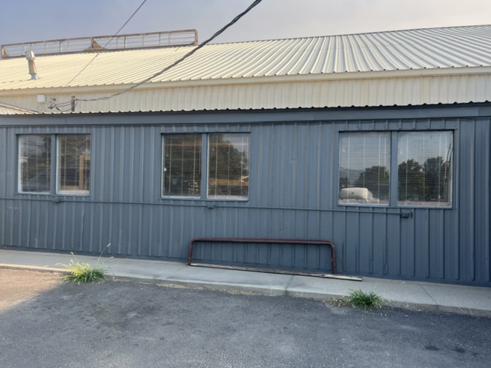
The long building that faces the street today is the stone warehouse under later skins. At its west end the stone stands exposed around a loading bay; along the street front a charcoal metal cladding covers the wall the Hornes once painted white; at the east end a clapboard office wing with a covered porch and a ramp, the successor of the small office the surveyors drew at the corner in 1884. Behind, along the track side, the stone is bare: arched openings, some filled with formed concrete in the decades when doors were no longer needed; barn doors of vertical plank; window wells cut into the wall, their iron bars rusted; patches of cement where openings were closed. The pointing has weathered out of the joints in places and the stone has cracked in others. The windows that remain are six-pane sashes; several have been cemented over.32

In 2026 the building was leased to Stephen Banker of Joshua Tree, a cabinetry business, whose plan for it is adaptive reuse: to work out of the warehouse, and to restore its exterior — the doors, the windows and their arches, the window wells, the broken stone and the failed pointing, the gutters that protect the walls — so that the building recovers its original, historical face and stands for generations more.32 The city’s Railroad Urban Renewal District, of which this parcel is a part, exists to help exactly that kind of work.8

The building lies just outside the boundary of the Helena Railroad Depot Historic District, listed on the National Register in 2004. It is not a contributing structure of that district; it is the same kind of building the district was drawn to protect, and older than the last stone warehouse the district was able to include.14 The city’s historic preservation officer, Pam Attardo, has already supplied maps and photographs to the applicant.32

The full street elevation of 1316 Bozeman Avenue today: the exposed stone bay with its loading door at left, the long metal-clad warehouse wall, and the clapboard office wing with its porch at right
Bozeman Avenue, the full frontage. The stone loading bay at the west end, the long warehouse wall under metal cladding, and the clapboard office wing at the east end. Project photograph.32
The maps

Helena on paper, 1880–1890

The maps gathered for this history: the full 1884 Sanborn sheet on which the first stone warehouse appears, the 1884 and 1892 key sheets that show where Bozeman Street sat in the growing city, the 1930 key, and the historic plats and map cards from the project’s files. The 1892 and 1930 detail sheets are in Chapter IV.15 16

The complete sheet 9 of the November 1884 Sanborn fire-insurance map of Helena
Sanborn fire-insurance map of Helena, November 1884, sheet 9 — the whole sheet. The Northern Pacific Addition, the depot, the rail road reservation, the lumber yards. Library of Congress — public domain.15
The key sheet of the November 1884 Sanborn map of Helena, with the Northern Pacific Addition drawn as an inset
Helena, November 1884 — the key sheet. The whole city on one page, population ten thousand; the Northern Pacific Addition drawn as an inset at the depot. Library of Congress — public domain.15
The 1892 Sanborn key map of Helena showing the sheet boundaries
Helena, 1892 — the key. Sixty-four sheets; sheet 50 covers Bozeman Street. Library of Congress — public domain.16
The 1930 Sanborn key map of Helena showing the sheet boundaries
Helena, 1930 — the key. Eighty-one sheets; sheet 222 covers the Bozeman Street warehouse row beside the Northern Pacific yard. Library of Congress — public domain.16
A historic plat of the Northern Pacific Addition from the project files
A historic plat from the project’s research files.
A historic map of Helena from the project files
A historic map of Helena from the project’s research files.
A grid of 1890 map cards of Helena from the project files
Map cards of Helena, 1890, from the project’s research files.
Sources

Where every statement comes from

  1. Helena Independent, October 19, 1935, “Heavy Damage in Sixth Ward from Violent Tremor.” Reprinted in University of Utah Seismograph Stations, 1935 Helena, MT series — News Articles, quake.utah.edu.
  2. Helena Independent, October 20, 1935 — the Christie liquor house west of the depot; the Northern Pacific yards. Same compilation.
  3. Helena Independent, October 22, 1935 — Shope and Roland, Nash-Finch employees in the office. Same compilation.
  4. Helena Independent, October 31, 1935, “Building Permits Issued to Repair Damage of Quake” — “Nash-Finch company; rebuild end walls and repair roof of company’s stone warehouse building; $900.” Same compilation.
  5. Helena Independent, November 1, 1935 — the Christie company of Butte at Logan and 13th, a different building. Same compilation.
  6. Helena Independent, November 12, 1935 — “the Nash-Finch, A. M. Holter and other warehouses are nearly restored.” Same compilation.
  7. Helena Weekly Herald, January 1884 — capital spent in the Northern Pacific Addition; as quoted in the National Register nomination (source 14).
  8. Lewis & Clark County property record, tax ID 2852 — 1316 Bozeman, Northern Pacific Addition Block 25 Lots 1–4 with 35 feet of closed Cooke Street, Section 29 T10N R3W; Railroad URD tax district. itax.tylertech.com.
  9. Lewis & Clark County property record, tax ID 25120 — 1315 Bozeman, Block 24 (the other Horne parcel). itax.tylertech.com.
  10. Lewis & Clark County Clerk & Recorder, EagleWeb public index — instruments on Northern Pacific Addn Block 25 Lots 1–4: mortgage 533388 (May 26, 1995), reconveyance 533951 (June 8, 1995, related Book M3 p. 278), mortgage 565062 (1997), mortgage 3086550 (2005), mortgage 3121626 (2007), deed 3141282 (December 31, 2007, Book M37 p. 7167, Horne Dorothy M Estate to Horne John L), assumption 3143012 (2008), deed 3187170 (May 26, 2010, re-record), reconveyance 3287733 (2016). eagle-web.lccountymt.gov.
  11. Lewis & Clark County Records Department — index from 1865; images by subscription, 406-447-8337. lccountymt.gov.
  12. Bureau of Land Management, General Land Office Records — patents, Township 10 N, Range 3 W, Section 29, Principal Meridian Montana. glorecords.blm.gov.
  13. Act of July 2, 1864, 13 Stat. 365, chartering the Northern Pacific Railroad Company; Minnesota Historical Society, Guide to the Northern Pacific Land Department Records. mnhs.org.
  14. National Register of Historic Places nomination, Helena Railroad Depot Historic District, NRIS 03001330, listed December 15, 2004 — the 1883 arrival, the Addition, the Herald of January 1884, Northwest Magazine 1887, the 1935 Independent, the Benson-Carpenter warehouse at 1439 North Harris (c. 1896).
  15. Sanborn Map & Publishing Co., Helena, Montana, November 1884, nine sheets; sheet 1 (key) and sheet 9 (Block 25, Kleinschmidt & Co. warehouse). Library of Congress, sanborn05017_001 — loc.gov; sheet 9 image via Wikimedia Commons — commons.wikimedia.org. Public domain.
  16. Sanborn Map Co., Helena, 1892 (64 sheets), sheet 50 — Bozeman Street, Kleinschmidt & Bro., A. M. Holter, Jas. McMillan & Co. — Library of Congress sanborn05017_004, loc.gov; and 1930 (81 sheets), sheet 222 — A. M. Holter Hardware Co., Mountain States Telephone Co., Union Wholesale Grocery Co., Swift & Co., Helena Fruit Co., house numbers 1300–1338 — sanborn05017_005, loc.gov. Public domain.
  17. Yale University Library, Sanborn atlas of Helena, 1930, with corrections through 1950. search.library.yale.edu.
  18. American Publishing Co., perspective map of Helena, 1890. Library of Congress. loc.gov.
  19. Montana Historical Society Library & Archives, photograph PAc 2015-23.19 (portal record p0008392) — the Christie truck at the State Liquor Warehouse, October 19, 1935. Montana History Portal, mtmemory.org. In copyright — educational use permitted; reproductions through MTHS Photograph Archives, 406-444-4739.
  20. Jon Axline, Cultural Resource Survey and Assessment: Caird Engineering Works (24LC2205), May 13, 2014 — Wilkinson’s 1871 purchase in Section 29; the Northern Pacific Addition of 1883. helenahistory.org.
  21. Montana Historical Society, Helena Abstract & Title Company records, 1864–1973 (MC 421) — abstract for Lot 5, Block 19, Northern Pacific Addition, “established by Allen M. Wilkinson in 1870.” Archives West, archiveswest.orbiscascade.org.
  22. University of North Dakota, Elwyn B. Robinson Department of Special Collections, Nash Finch Company Records — company history, 1885 to the present; Series 14, Photographs.
  23. Kennon Baird, “State Liquor Warehouse,” Helena As She Was. helenahistory.org.
  24. Kennon Baird, Helena As She Was, August 29, 2020 — caption to the Knudsen & Son photograph: the liquor warehouse “adjacent to the Nash-Finch food and beverage distributor warehouse, 1316 Bozeman. The warehouse was managed by the Christie Transfer & Storage Co.”
  25. George B. Staring, Helena City Directory, 1884 — Kleinschmidt Bros. & Co.; A. Kleinschmidt & Co.; Theodore H. Kleinschmidt, mayor. Internet Archive, archive.org.
  26. R. L. Polk & Co., Helena City Directory, 1922. FamilySearch Digital Library, item 806305.
  27. Montana Secretary of State, business records — Capital Transfer & Storage LLC, C176736 (organized November 14, 2007; registered agent John L. Horne, 1316 Bozeman Ave); Capital Transfer & Storage, assumed business name A067141 (1998); Union Mercantile Company, D000745 (September 3, 1888). biz.sosmt.gov.
  28. KTVH, “Capital Transfer and Storage closes after 76 years,” July 2026. ktvh.com.
  29. United States Geological Survey; University of Utah Seismograph Stations — the 1935 Helena earthquake series: October 12 (~M 5.9), October 18 (M 6.2), October 31 (M 6.0), November 28 (M 5.5); about 1,800 recorded tremors October 1935 – April 1936. See also KTVH, “History of the 1935 Earthquake,” ktvh.com.
  30. City of Helena, Railroad Urban Renewal District Plan; Tax Increment Financing application criteria (2018).
  31. Montana Historical Society finding aid — Kleinschmidt and Brothers, groceries and hardware, c. 1879–1896.
  32. Library of Congress, Sanborn Maps collection — rights and access: the online Sanborn maps are in the public domain. loc.gov.
  33. Northern Pacific depot, Helena, c. 1904 — postcard, Wikimedia Commons, commons.wikimedia.org. Public domain.
  34. The Joshua Tree project files — Stephen Banker’s application to the Railroad Urban Renewal District; the applicant’s photographs of the building, 2026; the historic maps and the papers gathered by Diane Anders.

The records behind this history

The research files this history was written from, each on its own page: the deeds, the patent, the maps, the newspapers, the directories, the corporate records, the register, the railroad, the photographs, the earthquakes — and the documents held in the project’s own files.